The following images were all taken near the same location, ~38.154842376709/122.950401306152:
Click on the small images to see the full-sized ones.
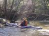
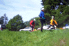
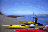
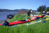
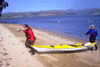
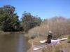 Kate DesLauriers at the Keys Creek put-in
Taken on 2008-02-10 .
Links to related images: Date. Proofs. Map. Story.
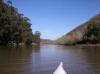
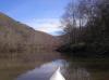
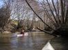
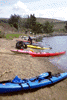
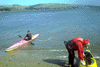
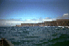
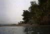
 Paddling up Keys Creek
Taken on 2008-02-10 .
Links to related images: Date. Proofs. Map. Story.
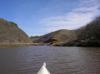
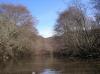
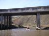
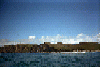
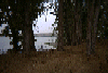
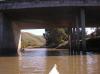 Under Highway One into the mouth of Walker Creek
Taken on 2008-02-10 .
Links to related images: Date. Proofs. Map. Story.

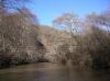
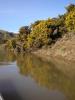
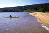
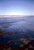
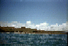
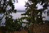
 Walker Creek
Taken on 2008-02-10 .
Links to related images: Date. Proofs. Map. Story.
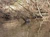 Walker Creek had many turtles
Taken on 2008-02-10 .
Links to related images: Date. Proofs. Map. Story.
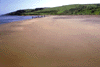
 Walker Creek
Taken on 2008-02-10 .
Links to related images: Date. Proofs. Map. Story.
 Kate DesLauriers in Walker Creek
Taken on 2008-02-10 .
Links to related images: Date. Proofs. Map. Story.
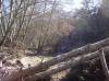
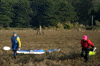
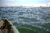
 We were unable to proceed farther up Walker Creek
Taken on 2008-02-10 .
Links to related images: Date. Proofs. Map. Story.
 Scotch broom beside Walker Creek
Taken on 2008-02-10 .
Links to related images: Date. Proofs. Map. Story.

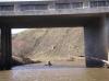 Kate Deslauriers going under Highway One on Walker Creek
Taken on 2008-02-10 .
Links to related images: Date. Proofs. Map. Story.
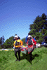
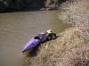 Kate Deslauriers gracefull exiting at the Keys Creek put-in
Taken on 2008-02-10 .
Links to related images: Date. Proofs. Map. Story.
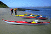
 Kayaks rounding the point into Tomales Bay
Taken on 2002-04-7 .
Links to related images: Date. Proofs. Map. Story.
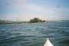
 Approaching Hog Island in Tomales Bay
Taken on 2002-04-7 .
Links to related images: Date. Proofs. Map. Story.
 Ellen in a slough
Taken on 1999-03-28 .
Links to related images: Date. Proofs. Map.
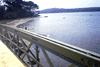
 Autobon Slough Bridge
Taken on 1999-03-28 .
Links to related images: Date. Proofs. Map.
 Kayaks from Autobon bridge
Taken on 1999-03-28 .
Links to related images: Date. Proofs. Map.
 Ellen from Autobon Bridge
Taken on 1999-03-28 .
Links to related images: Date. Proofs. Map.
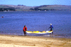
 Landing at Marconi Cove
Taken on 1999-03-28 .
Links to related images: Date. Proofs. Map.
 Unpacking the boats
Taken on 1999-03-28 .
Links to related images: Date. Proofs. Map.
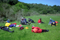
 Stopping for lunch
Taken on 1999-03-27 .
Links to related images: Date. Proofs. Map.
 Ellenlaunching
Taken on 1999-03-27 .
Links to related images: Date. Proofs. Map.
 Rick at lunch
Taken on 1999-03-27 .
Links to related images: Date. Proofs. Map.
 Lunch crowd
Taken on 1999-03-27 .
Links to related images: Date. Proofs. Map.
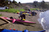
 Avala Beach
Taken on 1999-03-27 .
Links to related images: Date. Proofs. Map.
 Ellen and Christian at Avala Beach
Taken on 1999-03-27 .
Links to related images: Date. Proofs. Map.
 The intrepid kayaker at Avala Beach, Tomales Bay
Taken on 1999-03-27 .
Links to related images: Date. Proofs. Map.
 Tide rushing out past Avala Beach
Taken on 1999-03-27 .
Links to related images: Date. Proofs. Map.
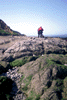 Hikers on Tomales Point
Taken on 1999-03-27 .
Links to related images: Date. Proofs. Map.
 Penny loading boat for expidition clinic
Taken on 1999-03-26 .
Links to related images: Date. Proofs. Map. Story.
 Packing at Marconi Cove
Taken on 1999-03-26 .
Links to related images: Date. Proofs. Map. Story.
 Ellen and Christian hauling at Marconi Cove
Taken on 1999-03-26 .
Links to related images: Date. Proofs. Map. Story.
 Basking at Indian Beach for lunch
Taken on 1999-03-26 .
Links to related images: Date. Proofs. Map. Story.
 Ellen and Paul hauling a boat at Marshal Beach
Taken on 1999-03-26 .
Links to related images: Date. Proofs. Map. Story.
 Penny landing at Marshal Beach
Taken on 1999-03-26 .
Links to related images: Date. Proofs. Map. Story.
 Sue Esty unloading her boat
Taken on 1999-03-26 .
Links to related images: Date. Proofs. Map. Story.
 Settup to cook dinner
Taken on 1999-03-26 .
Links to related images: Date. Proofs. Map. Story.
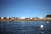
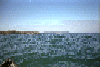
 Tomales Bay
Taken on 1998-01-4 .
Links to related images: Date. Proofs. Map.
 Corrina on Tomales Bay
Taken on 1998-01-4 .
Links to related images: Date. Proofs. Map.
 Frank and Corrina dragging across marsh
Taken on 1998-01-4 .
Links to related images: Date. Proofs. Map.
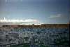
 The trailer park at Lawsons Landing near Dillon Beach.
Taken on 1997-11-2 .
Links to related images: Date. Proofs. Map. Story.
 McClures Beach is rough and difficult to launch from.
Taken on 1995-10-27 .
Links to related images: Date. Proofs. Map. Story.
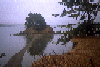
 A cove just south of McClures Beach.
Taken on 1995-10-27 .
Links to related images: Date. Proofs. Map. Story.


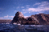
 Elephant Rock from many angles as I paddled around it.
Taken on 1995-10-27 .
Links to related images: Date. Proofs. Map. Story.
 A cove just south of McClures Beach.
Taken on 1995-10-27 .
Links to related images: Date. Proofs. Map. Story.


 Rough water around the rocks near McClures Beach.
Taken on 1995-10-27 .
Links to related images: Date. Proofs. Map. Story.
 Shoreline south of Elephant Rock.
Taken on 1995-10-27 .
Links to related images: Date. Proofs. Map. Story.
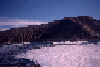
 View north towards Tomales Point and Bird Rock.
Taken on 1995-10-27 .
Links to related images: Date. Proofs. Map. Story.
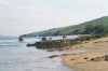
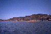
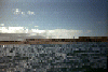
 McClures Beach viewed from offshore.
Taken on 1995-10-27 .
Links to related images: Date. Proofs. Map. Story.
 The Drakes Estero launch site at Johnson's Oyster Company
Taken on 1995-10-1 .
Links to related images: Date. Proofs. Map. Story.
 Elk on the shore of Tomales Bay
Taken on 1995-09-1 .
Links to related images: Date. Proofs. Map. Story.
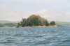
 Hog Island in the distance, up close, and some views from on the island.
Taken on 1995-09-1 .
Links to related images: Date. Proofs. Map. Story.
 Elk on the shore of Tomales Bay
Taken on 1995-09-1 .
Links to related images: Date. Proofs. Map. Story.
 The white cliffs of White Gulch on Tomales Bay
Taken on 1995-09-1 .
Links to related images: Date. Proofs. Map. Story.
 Hog Island in the distance, up close, and some views from on the island.
Taken on 1995-09-1 .
Links to related images: Date. Proofs. Map. Story.
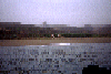 Tomales point, and Roosivelts Elk down on the beach:
Taken on 1995-09-1 .
Links to related images: Date. Proofs. Map. Story.
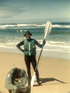 The intrepid kayaker in full gear just landed at Kehoe Beach.
Taken on 1995-06-18 .
Links to related images: Date. Proofs. Map. Story.
 Safely landed at Kehoe Beach.
Taken on 1995-06-18 .
Links to related images: Date. Proofs. Map. Story.


 Pictures of me approaching for a landing.
Taken on 1995-06-18 .
Links to related images: Date. Proofs. Map. Story.
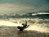
 Some pictures from way out at sea:
Taken on 1995-06-18 .
Links to related images: Date. Proofs. Map. Story.
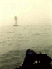
 A muir in the water with Kehoe Beach in the distance
Taken on 1995-06-18 .
Links to related images: Date. Map. Story.
 Looking north towards Tomales Point
Taken on 1995-06-18 .
Links to related images: Date. Map. Story.
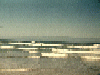
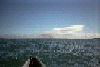
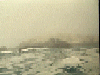
 Looking at Point Reyes Beach North from far out at sea
Taken on 1995-06-18 .
Links to related images: Date. Map. Story.
 Looking back towards Point Reyes
Taken on 1995-06-18 .
Links to related images: Date. Proofs. Map. Story.
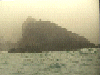
 Looking at Point Reyes Beach North from far out to sea
Taken on 1995-06-18 .
Links to related images: Date. Proofs. Map. Story.
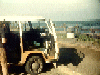 Getting my gear out of the VW bus at Point Reyes Beach North
Taken on 1995-06-18 .
Links to related images: Date. Proofs. Map. Story.
 Just round this point, is a calm cove with a mild beach that I
would have lau
Just round this point, is a calm cove with a mild beach that I
would have lau
Taken on ~1994 .
Links to related images: Date. Proofs. Map.
 Tomales Bay is calm as a lake, but has ocean critters:
Taken on ~1994 .
Links to related images: Date. Proofs. Map.
 Tomales point, and Roosivelts Elk down on the beach:
Taken on ~1994 .
Links to related images: Date. Proofs. Map.
 Duck Island and Hog Island
Taken on ~1994 .
Links to related images: Date. Proofs. Map.
 Hog Island in the distance, up close, and some views from on the island.
Taken on ~1994 .
Links to related images: Date. Proofs. Map.
All text and images Copyright © by Mike Higgins / contact