Point Reyes Beach North to Kehoe Beach, June 18 1995
Click on the small image to see the full-sized one.
 The intrepid kayaker in full gear just landed at Kehoe Beach.
Links to related images: Nearby. Proofs. Map.
Approximate location: 38.1548233032227N / 122.949798583984W.
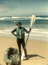
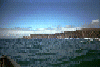
 Safely landed at Kehoe Beach.
Links to related images: Nearby. Proofs. Map.
Approximate location: 38.154842376709N / 122.950401306152W.


 Pictures of me approaching for a landing.
Links to related images: Nearby. Proofs. Map.
Approximate location: 38.1544036865234N / 122.952354431152W.
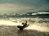
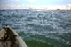
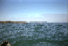
 Some pictures from way out at sea:
Links to related images: Nearby. Proofs. Map.
Approximate location: 38.1625022888184N / 122.958557128906W.
 A muir in the water with Kehoe Beach in the distance
Links to related images: Nearby. Map.
Approximate location: 38.1404304504395N / 122.964988708496W.
 Looking north towards Tomales Point
Links to related images: Nearby. Map.
Approximate location: 38.1392135620117N / 122.965591430664W.
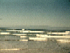
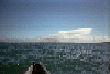
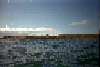 Looking at Point Reyes Beach North from far out at sea
Links to related images: Nearby. Map.
Approximate location: 38.1319236755371N / 122.967567443848W.
 Looking back towards Point Reyes
Links to related images: Nearby. Proofs. Map.
Approximate location: 38.1224708557129N / 122.97142791748W.
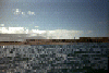 Looking at Point Reyes Beach North from far out to sea
Links to related images: Nearby. Proofs. Map.
Approximate location: 38.0960655212402N / 122.980697631836W.
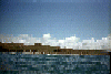
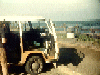 Getting my gear out of the VW bus at Point Reyes Beach North
Links to related images: Nearby. Proofs. Map.
Approximate location: 38.0777473449707N / 122.974983215332W.
All text and images Copyright © 1995 by Mike Higgins / contact