Dillon Beach to Miller Park, September 1st 1995
Click on the small image to see the full-sized one.
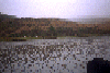
 Elk on the shore of Tomales Bay
Links to related images: Nearby. Proofs. Map.
Approximate location: 38.1941986083984N / 122.949996948242W.
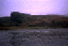
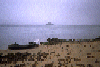
 Hog Island in the distance, up close, and some views from on the island.
Links to related images: Nearby. Proofs. Map.
Approximate location: 38.1964225769043N / 122.934562683105W.
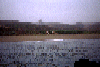
 Elk on the shore of Tomales Bay
Links to related images: Nearby. Proofs. Map.
Approximate location: 38.1950569152832N / 122.947998046875W.
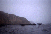
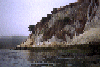 The white cliffs of White Gulch on Tomales Bay
Links to related images: Nearby. Proofs. Map.
Approximate location: 38.1951560974121N / 122.947952270508W.
 Hog Island in the distance, up close, and some views from on the island.
Links to related images: Nearby. Proofs. Map.
Approximate location: 38.2048683166504N / 122.950141906738W.
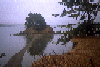
 Tomales point, and Roosivelts Elk down on the beach:
Links to related images: Nearby. Proofs. Map.
Approximate location: 38.2368316650391N / 122.983917236328W.
All text and images Copyright © 1995 by Mike Higgins / contact