Drakes Estero to Creamery Bay, October 1st, 1995.
Click on the small image to see the full-sized one.
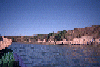
 Old pier pilings on the shore of Creamery Bay
Links to related images: Nearby. Proofs. Map.
Approximate location: 38.0687980651855N / 122.957077026367W.
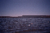
 The middle of Creamery Bay
Links to related images: Nearby. Proofs. Map.
Approximate location: 38.0675888061523N / 122.955764770508W.
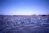
 A vast expance of Drakes Estero.
Links to related images: Nearby. Proofs. Map.
Approximate location: 38.0607986450195N / 122.93701171875W.
 The back of Marty's head and the shore of Creamery Bay
Links to related images: Nearby. Proofs. Map.
Approximate location: 38.0619468688965N / 122.956237792969W.
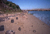
 The Drakes Estero launch site at Johnson's Oyster Company
Links to related images: Nearby. Proofs. Map.
Approximate location: 38.0825958251953N / 122.933288574219W.
All text and images Copyright © 1995 by Mike Higgins / contact