The following images were all taken near the same location, ~38.1224708557129/122.97142791748:
Click on the small images to see the full-sized ones.
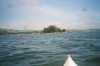
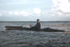
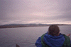
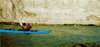
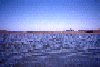
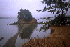
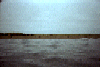
 Approaching Hog Island in Tomales Bay
Taken on 2002-04-7 .
Links to related images: Date. Proofs. Map. Story.
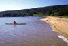
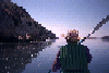
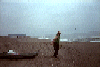
 Ellen in a slough
Taken on 1999-03-28 .
Links to related images: Date. Proofs. Map.
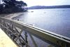
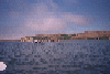
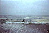
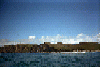
 Autobon Slough Bridge
Taken on 1999-03-28 .
Links to related images: Date. Proofs. Map.
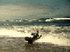
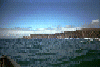
 Kayaks from Autobon bridge
Taken on 1999-03-28 .
Links to related images: Date. Proofs. Map.
 Ellen from Autobon Bridge
Taken on 1999-03-28 .
Links to related images: Date. Proofs. Map.
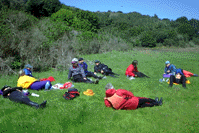
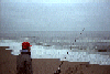
 Stopping for lunch
Taken on 1999-03-27 .
Links to related images: Date. Proofs. Map.
 Ellenlaunching
Taken on 1999-03-27 .
Links to related images: Date. Proofs. Map.
 Rick at lunch
Taken on 1999-03-27 .
Links to related images: Date. Proofs. Map.
 Lunch crowd
Taken on 1999-03-27 .
Links to related images: Date. Proofs. Map.
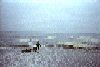
 Basking at Indian Beach for lunch
Taken on 1999-03-26 .
Links to related images: Date. Proofs. Map. Story.
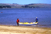
 Ellen and Paul hauling a boat at Marshal Beach
Taken on 1999-03-26 .
Links to related images: Date. Proofs. Map. Story.
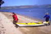
 Penny landing at Marshal Beach
Taken on 1999-03-26 .
Links to related images: Date. Proofs. Map. Story.
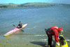
 Sue Esty unloading her boat
Taken on 1999-03-26 .
Links to related images: Date. Proofs. Map. Story.
 Settup to cook dinner
Taken on 1999-03-26 .
Links to related images: Date. Proofs. Map. Story.
 Joan at drakes estero
Taken on 1998-01-9 .
Links to related images: Date. Proofs. Map.
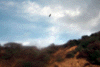 Fuzzy picture of a bird
Taken on 1998-01-9 .
Links to related images: Date. Proofs. Map.
 Vew out to sea from inside Drakes Estero
Taken on 1997-07-12 .
Links to related images: Date. Proofs. Map. Story.
 Cows at the end of Berries Bay
Taken on 1997-07-12 .
Links to related images: Date. Proofs. Map. Story.
 View out Berries Bay into Drakes Estero
Taken on 1997-07-12 .
Links to related images: Date. Proofs. Map. Story.
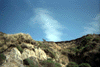
 View up a side valley from Berries Bay
Taken on 1997-07-12 .
Links to related images: Date. Proofs. Map. Story.
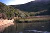
 The calm water inside Berries Bay
Taken on 1997-07-12 .
Links to related images: Date. Proofs. Map. Story.
 Red tail hawk above the bluff in Drakes Estero
Taken on 1997-07-12 .
Links to related images: Date. Proofs. Map. Story.
 The entrance to Berries Bay from Drakes Estero
Taken on 1997-07-12 .
Links to related images: Date. Proofs. Map. Story.
 A stag ran up the cliff as I paddled by on Drakes Estero
Taken on 1997-07-12 .
Links to related images: Date. Proofs. Map. Story.
 White egret on the shore of Drakes Estero
Taken on 1997-07-12 .
Links to related images: Date. Proofs. Map. Story.
 Broad expanse of Limantour Estero
Taken on 1996-11-30 .
Links to related images: Date. Proofs. Map. Story.
 Marty in the front seat of the Seda Explorer on Limantour Estero
Taken on 1996-11-30 .
Links to related images: Date. Proofs. Map. Story.
 Gail and Keith Hutchins paddling across Drakes Estero
Taken on 1996-07-28 .
Links to related images: Date. Proofs. Map. Story.

 Marty and Gail at Sunset Beach on Limantour Estero
Taken on 1996-07-28 .
Links to related images: Date. Proofs. Map. Story.
 Marty in the font seat on Drakes Estero
Taken on 1996-07-28 .
Links to related images: Date. Proofs. Map. Story.
 Gail and Keith trying out my double kayak
Taken on 1996-07-28 .
Links to related images: Date. Proofs. Map. Story.
 Drakes Estero oyster rack
Taken on 1996-01-12 .
Links to related images: Date. Proofs. Map. Story.

 Here are some oyster racks with bright clean shells and little
oyster sets star
Here are some oyster racks with bright clean shells and little
oyster sets star
Taken on 1996-01-12 .
Links to related images: Date. Proofs. Map. Story.
 In 18 months they will be large enough to eat, right now they are
invisible in
In 18 months they will be large enough to eat, right now they are
invisible in
Taken on 1996-01-12 .
Links to related images: Date. Proofs. Map. Story.
 I stuck my waterproof camera into the water as we drifted by and
caught these
I stuck my waterproof camera into the water as we drifted by and
caught these
Taken on 1996-01-12 .
Links to related images: Date. Proofs. Map. Story.
 Here are some oyster racks with bright clean shells and little
oyster sets star
Here are some oyster racks with bright clean shells and little
oyster sets star
Taken on 1996-01-12 .
Links to related images: Date. Proofs. Map. Story.
 I stuck my waterproof camera into the water as we drifted by and
caught these
I stuck my waterproof camera into the water as we drifted by and
caught these
Taken on 1996-01-12 .
Links to related images: Date. Proofs. Map. Story.
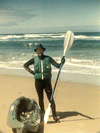
 The intrepid kayaker on Drakes Estero
Taken on 1996-01-12 .
Links to related images: Date. Proofs. Map. Story.
 Pictures of me on Drakes Estero taken by Joan Wiener.
Taken on 1996-01-12 .
Links to related images: Date. Proofs. Map. Story.
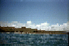
 A barge fully loaded with oysters on Drakes Estero
Taken on 1996-01-12 .
Links to related images: Date. Proofs. Map. Story.
 McClures Beach is rough and difficult to launch from.
Taken on 1995-10-27 .
Links to related images: Date. Proofs. Map. Story.
 A cove just south of McClures Beach.
Taken on 1995-10-27 .
Links to related images: Date. Proofs. Map. Story.


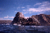
 Elephant Rock from many angles as I paddled around it.
Taken on 1995-10-27 .
Links to related images: Date. Proofs. Map. Story.
 A cove just south of McClures Beach.
Taken on 1995-10-27 .
Links to related images: Date. Proofs. Map. Story.


 Rough water around the rocks near McClures Beach.
Taken on 1995-10-27 .
Links to related images: Date. Proofs. Map. Story.
 Shoreline south of Elephant Rock.
Taken on 1995-10-27 .
Links to related images: Date. Proofs. Map. Story.
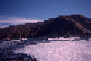
 View north towards Tomales Point and Bird Rock.
Taken on 1995-10-27 .
Links to related images: Date. Proofs. Map. Story.
 McClures Beach viewed from offshore.
Taken on 1995-10-27 .
Links to related images: Date. Proofs. Map. Story.
 Old pier pilings on the shore of Creamery Bay
Taken on 1995-10-1 .
Links to related images: Date. Proofs. Map. Story.
 The middle of Creamery Bay
Taken on 1995-10-1 .
Links to related images: Date. Proofs. Map. Story.
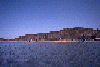
 A vast expance of Drakes Estero.
Taken on 1995-10-1 .
Links to related images: Date. Proofs. Map. Story.
 The back of Marty's head and the shore of Creamery Bay
Taken on 1995-10-1 .
Links to related images: Date. Proofs. Map. Story.
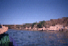
 The Drakes Estero launch site at Johnson's Oyster Company
Taken on 1995-10-1 .
Links to related images: Date. Proofs. Map. Story.
 Elk on the shore of Tomales Bay
Taken on 1995-09-1 .
Links to related images: Date. Proofs. Map. Story.
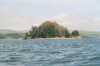
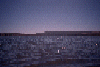
 Hog Island in the distance, up close, and some views from on the island.
Taken on 1995-09-1 .
Links to related images: Date. Proofs. Map. Story.
 Elk on the shore of Tomales Bay
Taken on 1995-09-1 .
Links to related images: Date. Proofs. Map. Story.
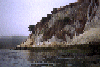 The white cliffs of White Gulch on Tomales Bay
Taken on 1995-09-1 .
Links to related images: Date. Proofs. Map. Story.
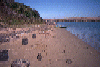
 Dunes offshore from Point Reyes Beach South
Taken on 1995-07-20 .
Links to related images: Date. Proofs. Map. Story.
 A fisherman in front of the intrepid kayaker at Point Reyes Beach South
Taken on 1995-07-20 .
Links to related images: Date. Proofs. Map. Story.
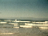
 The intrepid kayaker makes it over the surf at Point Reyes Beach South
Taken on 1995-07-20 .
Links to related images: Date. Proofs. Map. Story.
 The intrepid kayaker draging his kayak into the water at Point Reyes Beach South
Taken on 1995-07-20 .
Links to related images: Date. Proofs. Map. Story.
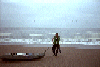
 The intrepid kayaker in full gear just landed at Kehoe Beach.
Taken on 1995-06-18 .
Links to related images: Date. Proofs. Map. Story.
 Safely landed at Kehoe Beach.
Taken on 1995-06-18 .
Links to related images: Date. Proofs. Map. Story.


 Pictures of me approaching for a landing.
Taken on 1995-06-18 .
Links to related images: Date. Proofs. Map. Story.
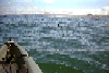
 Some pictures from way out at sea:
Taken on 1995-06-18 .
Links to related images: Date. Proofs. Map. Story.
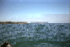
 A muir in the water with Kehoe Beach in the distance
Taken on 1995-06-18 .
Links to related images: Date. Map. Story.
 Looking north towards Tomales Point
Taken on 1995-06-18 .
Links to related images: Date. Map. Story.
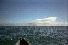
 Looking at Point Reyes Beach North from far out at sea
Taken on 1995-06-18 .
Links to related images: Date. Map. Story.
 Looking back towards Point Reyes
Taken on 1995-06-18 .
Links to related images: Date. Proofs. Map. Story.
 Looking at Point Reyes Beach North from far out to sea
Taken on 1995-06-18 .
Links to related images: Date. Proofs. Map. Story.
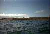
 Getting my gear out of the VW bus at Point Reyes Beach North
Taken on 1995-06-18 .
Links to related images: Date. Proofs. Map. Story.
All text and images Copyright © 1995 by Mike Higgins / contact