The following images were all taken near the same location, ~34.8371963500977/120.629196166992:
Click on the small images to see the full-sized ones.
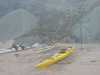 Packing the boats
at Point Sal Beach
Packing the boats
at Point Sal Beach
Taken on 2004-09-4 .
Links to related images: Date. Proofs. Map. Story.
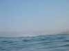
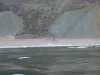 Offshore
at Point Sal Beach
Offshore
at Point Sal Beach
Taken on 2004-09-4 .
Links to related images: Date. Proofs. Map. Story.
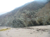
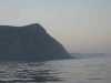 The start of Vandenburg property
at Point Sal Beach
The start of Vandenburg property
at Point Sal Beach
Taken on 2004-09-4 .
Links to related images: Date. Proofs. Map. Story.
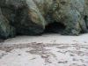
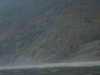 Looking at the last sand
at Point Sal Beach
Looking at the last sand
at Point Sal Beach
Taken on 2004-09-4 .
Links to related images: Date. Proofs. Map. Story.
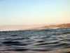
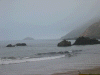
 Waves breaking over first point
at Point Sal Beach
Waves breaking over first point
at Point Sal Beach
Taken on 2004-09-4 .
Links to related images: Date. Proofs. Map. Story.
 Our first rocket gantry
at Vandenburg
Our first rocket gantry
at Vandenburg
Taken on 2004-09-4 .
Links to related images: Date. Proofs. Map. Story.
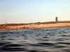
 Coastline
at Vandenburg
Coastline
at Vandenburg
Taken on 2004-09-4 .
Links to related images: Date. Proofs. Map. Story.
 Waves breaking over offshore rocks
at Purisima Point
Waves breaking over offshore rocks
at Purisima Point
Taken on 2004-09-4 .
Links to related images: Date. Proofs. Map. Story.
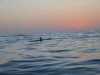 Fred after sunset
at Point Sal
Fred after sunset
at Point Sal
Taken on 2004-09-3 .
Links to related images: Date. Proofs. Map. Story.
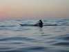 John after sunset
at Point Sal
John after sunset
at Point Sal
Taken on 2004-09-3 .
Links to related images: Date. Proofs. Map. Story.
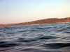
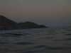 After sunset
at Point Sal
After sunset
at Point Sal
Taken on 2004-09-3 .
Links to related images: Date. Proofs. Map. Story.
 In the morning the conditions were rough and forecast to get worse. We decided
Taken on 2003-08-7 .
Links to related images: Date. Proofs. Map. Story.
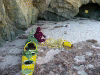
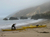
 The cave we camped in on Point Sal Beach.
Taken on 2003-08-6 .
Links to related images: Date. Proofs. Map. Story.
All text and images Copyright © 2003 by Mike Higgins / contact