Point Sal to Jamala State Beach, September 4th 2004.
Click on the small image to see the full-sized one.
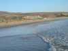
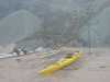 Packing the boats
at Point Sal Beach
Packing the boats
at Point Sal Beach
Links to related images: Nearby. Proofs. Map.
Approximate location: 34.8994903564453N / 120.645919799805W.
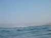
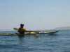
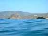
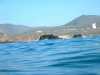
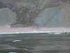 Offshore
at Point Sal Beach
Offshore
at Point Sal Beach
Links to related images: Nearby. Proofs. Map.
Approximate location: 34.8983726501465N / 120.64624786377W.
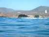
 The start of Vandenburg property
at Point Sal Beach
The start of Vandenburg property
at Point Sal Beach
Links to related images: Nearby. Proofs. Map.
Approximate location: 34.8941230773926N / 120.643966674805W.
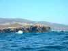
 Looking at the last sand
at Point Sal Beach
Looking at the last sand
at Point Sal Beach
Links to related images: Nearby. Proofs. Map.
Approximate location: 34.892749786377N / 120.644149780273W.
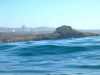
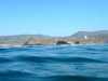
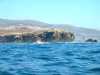
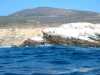
 Waves breaking over first point
at Point Sal Beach
Waves breaking over first point
at Point Sal Beach
Links to related images: Nearby. Proofs. Map.
Approximate location: 34.8921012878418N / 120.643905639648W.
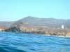
 Our first rocket gantry
at Vandenburg
Our first rocket gantry
at Vandenburg
Links to related images: Nearby. Proofs. Map.
Approximate location: 34.8884658813477N / 120.653060913086W.
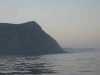
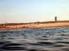
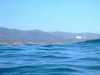
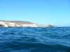
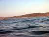 Coastline
at Vandenburg
Coastline
at Vandenburg
Links to related images: Nearby. Proofs. Map.
Approximate location: 34.8371963500977N / 120.629196166992W.
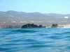
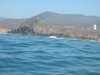
 Waves breaking over offshore rocks
at Purisima Point
Waves breaking over offshore rocks
at Purisima Point
Links to related images: Nearby. Proofs. Map.
Approximate location: 34.7641792297363N / 120.651168823242W.
 Fred Cooper paddling far offshore at Ocean Beach Park
Links to related images: Nearby. Proofs. Map.
Approximate location: 34.7071876525879N / 120.65185546875W.
 Fred paddling far offshore
at Ocean Beach Park
Fred paddling far offshore
at Ocean Beach Park
Links to related images: Nearby. Proofs. Map.
Approximate location: 34.7071876525879N / 120.65185546875W.
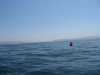
 John and Fred far offshore
at Ocean Beach Park
John and Fred far offshore
at Ocean Beach Park
Links to related images: Nearby. Proofs. Map.
Approximate location: 34.6919441223145N / 120.647048950195W.
 Rocket gantry
at Point Pedernales
Rocket gantry
at Point Pedernales
Links to related images: Nearby. Proofs. Map.
Approximate location: 34.6043167114258N / 120.648315429688W.
 Destroyer Rock
at Point Pedernales
Destroyer Rock
at Point Pedernales
Links to related images: Nearby. Proofs. Map.
Approximate location: 34.6039657592773N / 120.648208618164W.
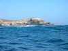
 Buildings
at Point Pedernales
Buildings
at Point Pedernales
Links to related images: Nearby. Proofs. Map.
Approximate location: 34.6000785827637N / 120.648315429688W.
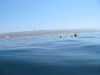
 John lost in the waves
at Point Pedernales
John lost in the waves
at Point Pedernales
Links to related images: Nearby. Proofs. Map.
Approximate location: 34.6000785827637N / 120.648315429688W.
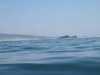
 John appearing between waves
at Point Pedernales
John appearing between waves
at Point Pedernales
Links to related images: Nearby. Proofs. Map.
Approximate location: 34.6000785827637N / 120.648315429688W.
 Buildings
at Point Pedernales
Buildings
at Point Pedernales
Links to related images: Nearby. Proofs. Map.
Approximate location: 34.6000785827637N / 120.648315429688W.
 Buildings
at Point Arguello
Buildings
at Point Arguello
Links to related images: Nearby. Proofs. Map.
Approximate location: 34.6000785827637N / 120.648315429688W.
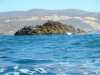
 The tip of land
at Point Arguello
The tip of land
at Point Arguello
Links to related images: Nearby. Proofs. Map.
Approximate location: 34.590648651123N / 120.648056030273W.
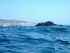
 The big offshore rock
at Point Arguello
The big offshore rock
at Point Arguello
Links to related images: Nearby. Proofs. Map.
Approximate location: 34.5763206481934N / 120.654541015625W.

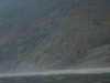
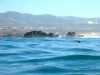
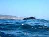
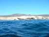
 Rough water
at Point Arguello
Rough water
at Point Arguello
Links to related images: Nearby. Proofs. Map.
Approximate location: 34.5747489929199N / 120.651794433594W.
 The big offshore rock
at Point Arguello
The big offshore rock
at Point Arguello
Links to related images: Nearby. Proofs. Map.
Approximate location: 34.5747489929199N / 120.651794433594W.
 The first point
at Rocky Point
The first point
at Rocky Point
Links to related images: Nearby. Proofs. Map.
Approximate location: 34.5635452270508N / 120.644218444824W.
 The second point
at Rocky Point
The second point
at Rocky Point
Links to related images: Nearby. Proofs. Map.
Approximate location: 34.5585250854492N / 120.638809204102W.
 John Somers landed at Jalama Beach
Links to related images: Nearby. Proofs. Map.
Approximate location: 34.5124816894531N / 120.503753662109W.
 The railroad trestle
at Jalama Beach
The railroad trestle
at Jalama Beach
Links to related images: Nearby. Proofs. Map.
Approximate location: 34.5123138427734N / 120.50358581543W.
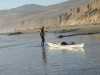
 My kayak at our camping beach
at Jalama Beach
My kayak at our camping beach
at Jalama Beach
Links to related images: Nearby. Proofs. Map.
Approximate location: 34.515007019043N / 120.505363464355W.
 The public beach
at Jalama Beach
The public beach
at Jalama Beach
Links to related images: Nearby. Proofs. Map.
Approximate location: 34.5139122009277N / 120.504890441895W.
 John Somers and Fred Cooper setting up camp at Jalama Beach
Links to related images: Nearby. Proofs. Map.
Approximate location: 34.5150337219238N / 120.505264282227W.
 John and Fred setting up camp
at Jalama Beach
John and Fred setting up camp
at Jalama Beach
Links to related images: Nearby. Proofs. Map.
Approximate location: 34.5150337219238N / 120.505264282227W.

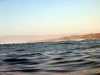
 Morning sunlight on the waves
Links to related images: Nearby. Proofs. Map.
Approximate location: 34.5150337219238N / 120.505264282227W.
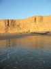
 Morning sunlight on Vandenburg
Links to related images: Nearby. Proofs. Map.
Approximate location: 34.5150337219238N / 120.505264282227W.
All text and images Copyright © 2004 by Mike Higgins / contact