Double Rock to Point Sal, August 6th 2003.
Click on the small image to see the full-sized one.
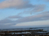
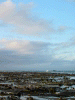
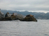
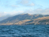 Morning light as we paddled south.
Links to related images: Nearby. Proofs. Map.
Approximate location: 35.1861190795898N / 120.817596435547W.
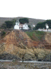
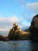
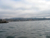 The lighthouse and the end of the breakwater at Port San Luis.
Links to related images: Nearby. Proofs. Map.
Approximate location: 35.155704498291N / 120.750091552734W.
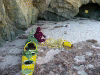
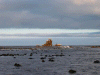
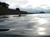
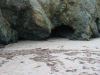 The cave we camped in on Point Sal Beach.
Links to related images: Nearby. Proofs. Map.
Approximate location: 34.9006805419922N / 120.647048950195W.
All text and images Copyright © 2003 by Mike Higgins / contact