Pismo Beach to Point Sal, September 3rd 2004.
Click on the small image to see the full-sized one.
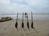 John Somers preparing to launch at Pismo Beach
Links to related images: Nearby. Proofs. Map.
Approximate location: 35.1277618408203N / 120.638305664062W.
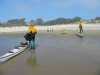 John Somers and Fred Cooper preparing to launch at Pismo Beach
Links to related images: Nearby. Proofs. Map.
Approximate location: 35.1277618408203N / 120.638305664062W.
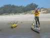 Fred Cooper preparing to launch at Pismo Beach
Links to related images: Nearby. Proofs. Map.
Approximate location: 35.1277618408203N / 120.638305664062W.
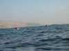 John and Fred pulling ahead
at Pismo Dunes
John and Fred pulling ahead
at Pismo Dunes
Links to related images: Nearby. Proofs. Map.
Approximate location: 35.1219100952148N / 120.639671325684W.
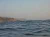
 The end of the dunes
at Pismo Dunes
The end of the dunes
at Pismo Dunes
Links to related images: Nearby. Proofs. Map.
Approximate location: 34.9506797790527N / 120.679664611816W.
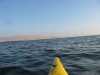
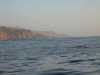 Distant Point Sal
at Mussel Point
Distant Point Sal
at Mussel Point
Links to related images: Nearby. Proofs. Map.
Approximate location: 34.9506797790527N / 120.679664611816W.
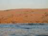
 The Point
at Mussel Point
The Point
at Mussel Point
Links to related images: Nearby. Proofs. Map.
Approximate location: 34.9332313537598N / 120.67211151123W.
 Rock layer
at Mussel Point
Rock layer
at Mussel Point
Links to related images: Nearby. Proofs. Map.
Approximate location: 34.9180297851562N / 120.674171447754W.
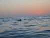 Fred after sunset
at Point Sal
Fred after sunset
at Point Sal
Links to related images: Nearby. Proofs. Map.
Approximate location: 34.9064865112305N / 120.678634643555W.
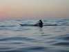 John after sunset
at Point Sal
John after sunset
at Point Sal
Links to related images: Nearby. Proofs. Map.
Approximate location: 34.9045143127441N / 120.675888061523W.
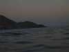 After sunset
at Point Sal
After sunset
at Point Sal
Links to related images: Nearby. Proofs. Map.
Approximate location: 34.9045143127441N / 120.675888061523W.
All text and images Copyright © 2004 by Mike Higgins / contact