The following images were all taken near the same location, ~40.2080993652344/124.294998168945:
Click on the small images to see the full-sized ones.
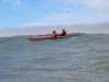
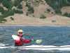
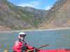
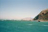
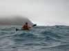 Fred Cooper paddling south to Punta Gorda
Taken on 2005-09-3 .
Links to related images: Date. Proofs. Map. Story.
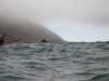
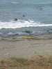
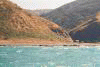
 BASKers paddling south to Punta Gorda
Taken on 2005-09-3 .
Links to related images: Date. Proofs. Map. Story.
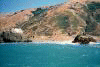
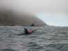 Dave Littlejohn and the first glimpse of the Punta Gorda Lighthouse
Taken on 2005-09-3 .
Links to related images: Date. Proofs. Map. Story.


 Pictures of my friends from the beach at the Punta Gorda Lighthouse
Taken on 2005-09-3 .
Links to related images: Date. Proofs. Map. Story.


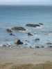
 An old buoy at the Punta Gorda Lighthouse
Taken on 2005-09-3 .
Links to related images: Date. Proofs. Map. Story.
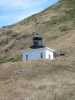 The Punta Gorda Lighthouse from the beach
Taken on 2005-09-3 .
Links to related images: Date. Proofs. Map. Story.
 BASKers viewed from up by to the Punta Gorda Lighthouse
Taken on 2005-09-3 .
Links to related images: Date. Proofs. Map. Story.
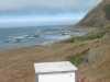
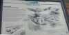 The sign next to the Punta Gorda Lighthouse
Taken on 2005-09-3 .
Links to related images: Date. Proofs. Map. Story.
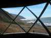
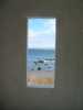 View out the window of the Punta Gorda Lighthouse
Taken on 2005-09-3 .
Links to related images: Date. Proofs. Map. Story.
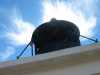
 View out the cuppola of the Punta Gorda Lighthouse
Taken on 2005-09-3 .
Links to related images: Date. Proofs. Map. Story.
 My kayak viewed from the cuppola of the Punta Gorda Lighthouse
Taken on 2005-09-3 .
Links to related images: Date. Proofs. Map. Story.
 Views north and south from the cuppola of the Punta Gorda Lighthouse
Taken on 2005-09-3 .
Links to related images: Date. Proofs. Map. Story.
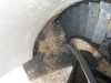
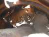
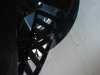 The spiral staircase of the Punta Gorda Lighthouse
Taken on 2005-09-3 .
Links to related images: Date. Proofs. Map. Story.
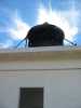 Sky behind the cuppola of the Punta Gorda Lighthouse
Taken on 2005-09-3 .
Links to related images: Date. Proofs. Map. Story.

 The Lost Coast Trail north and south from the Punta Gorda Lighthouse
Taken on 2005-09-3 .
Links to related images: Date. Proofs. Map. Story.
 Abandoned cabin on the Lost Coast Trail
Taken on 2005-09-3 .
Links to related images: Date. Proofs. Map. Story.
 Don Fleming and Dave Littlejohn south of Punta Gorda
Taken on 2005-09-3 .
Links to related images: Date. Proofs. Map. Story.
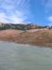
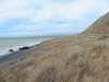
 The north half of the Lost Coast Trail has its own rolling golden hill beauty
Taken on 2005-09-3 .
Links to related images: Date. Proofs. Map. Story.
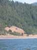
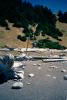
 Landed north of Spanish Flat for a lunch stop
Taken on 2005-09-3 .
Links to related images: Date. Proofs. Map. Story.
 Mark Short napping at lunch, north of Spanish Flat
Taken on 2005-09-3 .
Links to related images: Date. Proofs. Map. Story.
 D�rte Mann beachcombing at lunch, north of Spanish Flat
Taken on 2005-09-3 .
Links to related images: Date. Proofs. Map. Story.

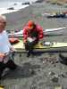 Fred Cooper and Lucy O'Brien at lunch, north of Spanish Flat
Taken on 2005-09-3 .
Links to related images: Date. Proofs. Map. Story.
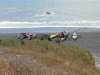
 BASKers launching after lunch, north of Spanish Flat
Taken on 2005-09-3 .
Links to related images: Date. Proofs. Map. Story.
 Inviting valley at the start of Spanish Flat
Taken on 2005-09-3 .
Links to related images: Date. Proofs. Map. Story.

 Lucy O'Brien in front of the cabin at Spanish Flat
Taken on 2005-09-3 .
Links to related images: Date. Proofs. Map. Story.

 There's a car on a dirt road hidden in the hill here at Spanish Flat
Taken on 2005-09-3 .
Links to related images: Date. Proofs. Map. Story.

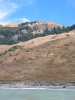
 Dave Littlejohn and D�rte Mann in front of burned off hill at Spanish Flat
Taken on 2005-09-3 .
Links to related images: Date. Proofs. Map. Story.

 Mark Short in front of well maintained cabin at Spanish Flat
Taken on 2005-09-3 .
Links to related images: Date. Proofs. Map. Story.
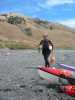
 Dave Littlejohn at the south end of Spanish Flat
Taken on 2005-09-3 .
Links to related images: Date. Proofs. Map. Story.
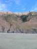
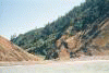
 Patchwork forrest fire damage at the south end of Spanish Flat
Taken on 2005-09-3 .
Links to related images: Date. Proofs. Map. Story.
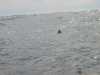
 Mother and baby muir near Spanish Flat
Taken on 2005-09-3 .
Links to related images: Date. Proofs. Map. Story.

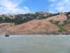
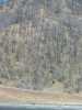
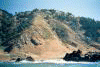
 Rounding Punta Gorda. (Do you see the hikers on the Lost Coast Trail?)
Taken on 2000-08-15 .
Links to related images: Date. Proofs. Map. Story.

 The Punta Gorda Lighthouse is low and close to the water.
Taken on 2000-08-15 .
Links to related images: Date. Proofs. Map. Story.
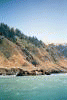

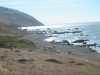
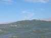
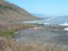
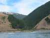
 Norther Lost Coast shoreline.
Taken on 2000-08-15 .
Links to related images: Date. Proofs. Map. Story.

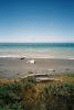

 I land at Spanish Flat but don't like the exposed beach for camping.
Taken on 2000-08-15 .
Links to related images: Date. Proofs. Map. Story.

 I continue down the coast looking for a protected place.
Taken on 2000-08-15 .
Links to related images: Date. Proofs. Map. Story.
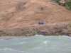
 I land behind False Cape for a break.
Taken on 2000-08-13 .
Links to related images: Date. Proofs. Map. Story.
All text and images Copyright © 2000 by Mike Higgins / contact