Humboldt County, Humboldt Bay to Cape Mendocino, August 13th, 2000.
Click on the small image to see the full-sized one.
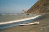
 Launching the next day for another long paddle past sandy beaches with little t
Links to related images: Nearby. Proofs. Map.
Approximate location: 40.7646636962891N / 124.240089416504W.
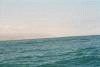
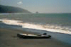
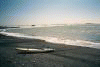
 Another long paddle past sandy beaches with little to look at.
Links to related images: Nearby. Proofs. Map.
Approximate location: 40.5461578369141N / 124.383087158203W.
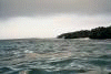
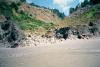
 Bump in the shoreline, something to look at!
Links to related images: Nearby. Proofs. Map.
Approximate location: 40.5169296264648N / 124.397506713867W.
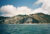
 Distant hills, something to look at!
Links to related images: Nearby. Proofs. Map.
Approximate location: 40.4840354919434N / 124.407806396484W.
 Another long paddle past sandy beaches with little to look at.
Links to related images: Nearby. Proofs. Map.
Approximate location: 40.5229339599609N / 124.397850036621W.
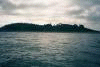
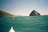
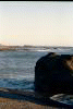
 False Point in the distance, something to look at!
Links to related images: Nearby. Proofs. Map.
Approximate location: 40.4939575195312N / 124.400939941406W.

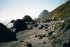
 The shoreline starts to get interesting again
Links to related images: Nearby. Proofs. Map.
Approximate location: 40.4038238525391N / 124.405403137207W.


 I land behind False Cape for a break.
Links to related images: Nearby. Proofs. Map.
Approximate location: 40.5011405944824N / 124.384460449219W.

 The view ahead to the real Cape Mendocino.
Links to related images: Nearby. Proofs. Map.
Approximate location: 40.452693939209N / 124.409004211426W.

 Wind and rough seas prevented taking many good pictures.
Links to related images: Nearby. Proofs. Map.
Approximate location: 40.4443359375N / 124.411750793457W.

 Until I landed below the point for the evening.
Links to related images: Nearby. Proofs. Map.
Approximate location: 40.4334259033203N / 124.404075622559W.
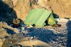
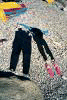 And set up my campsite.
Links to related images: Nearby. Proofs. Map.
Approximate location: 40.4345664978027N / 124.405227661133W.
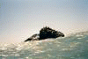
 On a walk around the point I see Seamboat rock, California sea lions and the li
Links to related images: Nearby. Proofs. Map.
Approximate location: 40.4359092712402N / 124.407722473145W.
 And set up my campsite.
Links to related images: Nearby. Proofs. Map.
Approximate location: 40.4346008300781N / 124.4052734375W.
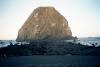 Sugarloaf Island viewed from shore by evening light.
Links to related images: Nearby. Proofs. Map.
Approximate location: 40.4385871887207N / 124.409736633301W.
All text and images Copyright © 2000 by Mike Higgins / contact