The following images were all taken near the same location, ~38.00104/122.3665:
Click on the small images to see the full-sized ones.

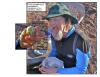
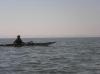
 Fran Sticha launching at Point Pinole
Taken on 2012-10-1 .
Links to related images: Date. Proofs. Map.
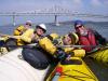
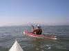
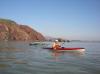
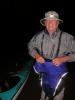
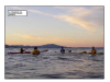
 Bo Barnes in the calm water of San Pablo Bay
Taken on 2012-10-1 .
Links to related images: Date. Map.
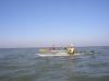
 Laura Ayers in the calm water of San Pablo Bay
Taken on 2012-10-1 .
Links to related images: Date. Map.
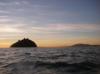
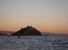
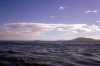
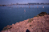
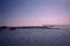
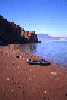
 The little arch on the north end of San Pablo Bay
Taken on 2012-10-1 .
Links to related images: Date. Map.

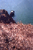
 An egret on the north end of San Pablo Bay
Taken on 2012-10-1 .
Links to related images: Date. Map.
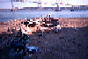
 Landing at Point Pinole
Taken on 2012-09-30 .
Links to related images: Date. Proofs. Map.
 Jackie Mendiola and Fran Sticha landing at Point Pinole
Taken on 2012-09-30 .
Links to related images: Date. Proofs. Map.

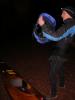
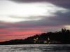
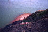
 Moonrise at Point Pinole
Taken on 2012-09-30 .
Links to related images: Date. Proofs. Map.
 Packing the boats in the morning at Point Pinole
Taken on 2011-10-20 .
Links to related images: Date. Proofs. Map.
 Penny Wells and Andrea wolf packing the double in the morning at Point Pinole
Taken on 2011-10-20 .
Links to related images: Date. Proofs. Map.


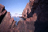
 I went through this arch, Don Flemming chose not to scratch up his boat
Taken on 2011-10-20 .
Links to related images: Date. Map.
 Fran Sticha taking it easy at Point Pinole
Taken on 2011-10-19 .
Links to related images: Date. Proofs. Map.
 Bo Barnes and Paul Nixon disrobing at Point Pinole
Taken on 2011-10-19 .
Links to related images: Date. Proofs. Map.


 Bo Barnes and Paul Nixon going swimming at Point Pinole
Taken on 2011-10-19 .
Links to related images: Date. Proofs. Map.
 Fran Sticha taking it easy at Point Pinole
Taken on 2011-10-19 .
Links to related images: Date. Proofs. Map.

 Bo Barnes and Paul Nixon going swimming at Point Pinole
Taken on 2011-10-19 .
Links to related images: Date. Proofs. Map.
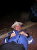
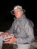
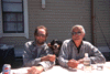
 Don Fleming joins us for dinner at Point Pinole
Taken on 2011-10-19 .
Links to related images: Date. Proofs. Map.
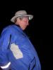
 John Boeschen joins us for dinner at Point Pinole
Taken on 2011-10-19 .
Links to related images: Date. Proofs. Map.

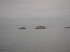
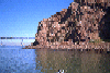
 Passing between the Brother Islands
Taken on 2011-03-19 .
Links to related images: Date. Proofs. Map. Story.

 Rounding Rat Rock
Taken on 2011-03-19 .
Links to related images: Date. Proofs. Map. Story.

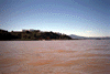
 From the train we saw Eckley Park
Taken on 2010-10-9 .
Links to related images: Date. Map.
 From the train we saw The Nantucket restaurant
Taken on 2010-10-9 .
Links to related images: Date.
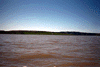
 From the train we saw Lone Tree Point
Taken on 2010-10-9 .
Links to related images: Date. Proofs. Map.

 Paul Nixon cut his foot while swimming, had to keep it dry in a dry-bag
Taken on 2010-10-8 .
Links to related images: Date. Proofs. Map.
 Fran Sticha packing up to leave Point Pinole
Taken on 2010-10-8 .
Links to related images: Date. Proofs. Map.
 Sojourners packing up to leave Point Pinole
Taken on 2010-10-8 .
Links to related images: Date. Proofs. Map.
 Bo Barnes washing dishes at the San Pablo Sportsmans Club
Taken on 2010-10-7 .
Links to related images: Date. Proofs. Map.
 Fran Sticha packing up to join us at the San Pablo Sportsmans Club
Taken on 2010-10-7 .
Links to related images: Date. Proofs. Map.
 Packing up on the beach at the San Pablo Sportsmans Club
Taken on 2010-10-7 .
Links to related images: Date. Proofs. Map.
 The Kayak Queen in her throne waiting for the rest of us to finish packintg
Taken on 2010-10-7 .
Links to related images: Date. Proofs. Map.

 The intrepid kayaker reading a book waiting for everyone else to finish packing
Taken on 2010-10-7 .
Links to related images: Date. Proofs. Map.


 Some of us paddle up the San Pablo Creek
Taken on 2010-10-7 .
Links to related images: Date. Proofs. Map.
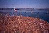
 Salt Grass at Point Pinole
Taken on 2010-10-7 .
Links to related images: Date. Proofs. Map.
 Fran Sticha and Penny Wells approach the pier at Point Pinole
Taken on 2010-10-7 .
Links to related images: Date. Proofs. Map.
 Fran sticha and Penny Wells approach the pier at Point Pinole
Taken on 2010-10-7 .
Links to related images: Date. Proofs. Map.

 The kayaks stacked for the evening at Point Pinole
Taken on 2010-10-7 .
Links to related images: Date. Proofs. Map.
 Penny Wells is poised no matter what she is wearing or where she is
Taken on 2010-10-7 .
Links to related images: Date. Proofs. Map.
 Looking back down the fishing pier at Point Pinole
Taken on 2010-10-7 .
Links to related images: Date. Proofs. Map.
 Our tents set up at the Point San Pablo Yacht Club
Taken on 2010-10-6 .
Links to related images: Date. Proofs. Map.
 Packing up to leave the Point San Pablo Yacht Club
Taken on 2010-10-6 .
Links to related images: Date. Proofs. Map.

 Steve Shepard moving his sailboat to shore
Taken on 2010-10-6 .
Links to related images: Date. Proofs. Map.
 Penny Wells found this whirlpool where the tide flowed backwards up into a storm drain
Taken on 2010-10-6 .
Links to related images: Date. Proofs. Map.

 Approaching Red Rock Island
Taken on 2010-10-6 .
Links to related images: Date. Proofs. Map.

 Sojourners lunching on Red Rock Island
Taken on 2010-10-6 .
Links to related images: Date. Proofs. Map.
 Dinner at the San Pablo Sportsmans Club
Taken on 2010-10-6 .
Links to related images: Date. Proofs. Map.
 We meet more Sojourners at the Point San Pablo Yacht Club
Taken on 2010-10-5 .
Links to related images: Date. Proofs. Map.
 Bo Barnes and Paul Nixon land at the Point San Pablo Yacht Club
Taken on 2010-10-5 .
Links to related images: Date. Proofs. Map.
 Kayaks stacked up at the Point San Pablo Yacht Club
Taken on 2010-10-5 .
Links to related images: Date. Proofs. Map.
 Penny Wells talking up the locals at the Point San Pablo Yacht Club
Taken on 2010-10-5 .
Links to related images: Date. Proofs. Map.
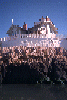
 Sojourners at the Point San Pablo Yacht Club
Taken on 2010-10-5 .
Links to related images: Date. Proofs. Map.
 Steve Shepard arrived at the Point San Pablo Yacht Club by salboat
Taken on 2010-10-5 .
Links to related images: Date. Proofs. Map.
 Half way up the poison oak free scramble to the top of Red Rock
Taken on 2009-09-12 .
Links to related images: Date. Proofs. Map. Story.


 Danny Forer took the Poison Oak route
Taken on 2009-09-12 .
Links to related images: Date. Proofs. Map. Story.
 The Chevron Pier and Richmond from the top of Red Rock
Taken on 2009-09-12 .
Links to related images: Date. Proofs. Map. Story.
 The Richmond/San Rafael Bridge from the top of Red Rock
Taken on 2009-09-12 .
Links to related images: Date. Proofs. Map. Story.
 A row of decorative flowers on the top of Red Rock
Taken on 2009-09-12 .
Links to related images: Date. Proofs. Map. Story.

 Eco Terrorist Trash and a view of Toilet Bowl Beach from the top of Red Rock
Taken on 2009-09-12 .
Links to related images: Date. Proofs. Map. Story.


 Danny and I clean up the trash left by Earth First Eco Terrorists
Taken on 2009-09-12 .
Links to related images: Date. Proofs. Map. Story.
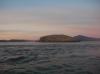
 View of Angel Island from the top of Red Rock
Taken on 2009-09-12 .
Links to related images: Date. Proofs. Map. Story.
 View of the Richmond San Rafael Bridge and Marin from the top of Red Rock
Taken on 2009-09-12 .
Links to related images: Date. Proofs. Map. Story.
 View of the Richmond San Rafael Bridge from the top of Red Rock
Taken on 2009-09-12 .
Links to related images: Date. Proofs. Map. Story.
 The Intrepid Kayaker (and Danny Forers thumb) on top of Red Rock Island
Taken on 2009-09-12 .
Links to related images: Date. Proofs. Map. Story.

 The Intrepid Kayaker hauling off the trash left by Earth First Eco Terrorists on Red Rock Island
Taken on 2009-09-12 .
Links to related images: Date. Proofs. Map. Story.
 Danny Forers kaysk loaded down with trash left by Earth First Eco Terrorists on Red Rock Island
Taken on 2009-09-12 .
Links to related images: Date. Proofs. Map. Story.
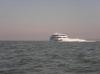
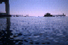
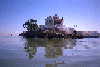
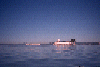
 Supertankers pass in front of us, ferries behind us
Taken on 2008-10-12 .
Links to related images: Date. Proofs. Map. Story.
 Safely landed on Red Rock for lunch
Taken on 2008-10-12 .
Links to related images: Date. Proofs. Map. Story.


 Another ferry and sail boat on the way back to Ferry Point
Taken on 2008-10-12 .
Links to related images: Date. Proofs. Map. Story.

 The sun rising over my campsite on Toilet Bowl Beach
Taken on 2008-10-10 .
Links to related images: Date. Proofs. Map.
 Thurseve Paddlers around the campfire on Toilet Bowl Beach
Taken on 2008-10-9 .
Links to related images: Date. Proofs. Map. Story.
 Keltic Kim enjoys her first Thurseve Paddle
Taken on 2008-10-9 .
Links to related images: Date. Proofs. Map. Story.
 Thurseve Paddlers around the campfire on Toilet Bowl Beach
Taken on 2008-10-9 .
Links to related images: Date. Proofs. Map. Story.
 Keltic Kim by campfire light on Toilet Bowl Beach
Taken on 2008-10-9 .
Links to related images: Date. Proofs. Map. Story.
 The mayor and Keltic Kim on Toilet Bowl Beach
Taken on 2008-10-9 .
Links to related images: Date. Proofs. Map. Story.

 John Boeschen putting out our campfire by dragging it into The Bay
Taken on 2008-10-9 .
Links to related images: Date. Proofs. Map. Story.
 Most of the Thurseve Paddlers paddle home for the evening, with running lights on
Taken on 2008-10-9 .
Links to related images: Date. Proofs. Map. Story.
 My ninja camp on Toilet Bowl Beach
Taken on 2008-09-19 .
Links to related images: Date. Proofs. Map.

 South end of Red Rock Island at sunset
Taken on 2008-09-18 .
Links to related images: Date. Proofs. Map. Story.

 Landing on Toilet Bowl Beach
Taken on 2008-09-18 .
Links to related images: Date. Proofs. Map. Story.
 My ninja camp on Toilet Bowl Beach
Taken on 2008-09-18 .
Links to related images: Date. Proofs. Map. Story.


 Jonathan Purcell, John Boeschen and the Hobo play in the water swirling around West Sister Island
Taken on 2008-09-4 .
Links to related images: Date. Proofs. Map. Story.
 Approaching Red Rock Island
Taken on 2008-04-3 .
Links to related images: Date. Proofs. Map. Story.
 Car-carrier ship rounding Red Rock Island
Taken on 2008-04-3 .
Links to related images: Date. Proofs. Map. Story.
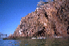
 Red Rock Island in the morning
Taken on 2008-03-28 .
Links to related images: Date. Proofs. Map.

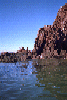
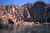
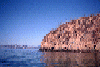
 I wonder why they call this island Red Rock
Taken on 2008-03-27 .
Links to related images: Date. Proofs. Map. Story.
 Penny Wells approaching Red Rock
Taken on 2008-03-27 .
Links to related images: Date. Proofs. Map. Story.
 I wonder why they call this island Red Rock
Taken on 2008-03-27 .
Links to related images: Date. Proofs. Map. Story.

 Penny Wells rounding the south end of Red Rock
Taken on 2008-03-27 .
Links to related images: Date. Proofs. Map. Story.
 Gordon Schanck rounding the south end of Red Rock
Taken on 2008-03-27 .
Links to related images: Date. Proofs. Map. Story.
 I wonder why they call this island Red Rock
Taken on 2008-03-27 .
Links to related images: Date. Proofs. Map. Story.
 In the shadow of Red Rock Island
Taken on 2008-03-27 .
Links to related images: Date. Proofs. Map. Story.

 Thurseve Paddlers landing on Toilet Bowl Beach on Red Rock Island
Taken on 2008-03-27 .
Links to related images: Date. Proofs. Map. Story.
 John Boeschen on Toilet Bowl Beach
Taken on 2008-03-27 .
Links to related images: Date. Proofs. Map. Story.
 Thurseve Paddlers on Toilet Bowl Beach
Taken on 2008-03-27 .
Links to related images: Date. Proofs. Map. Story.
 Stone soup started with red stones from Red Rock Island
Taken on 2008-03-27 .
Links to related images: Date. Proofs. Map. Story.


 John Boeschen sitting next to brussels sprouts on Red Rock Island
Taken on 2008-03-27 .
Links to related images: Date. Proofs. Map. Story.
 John Boeschen and Penny Wells Red Rock Island
Taken on 2008-03-27 .
Links to related images: Date. Proofs. Map. Story.


 John Boeschen is willing to try one brussels sprout
Taken on 2008-03-27 .
Links to related images: Date. Proofs. Map. Story.
 Gordon Schanck enjoying a brussels sprout
Taken on 2008-03-27 .
Links to related images: Date. Proofs. Map. Story.
 Thurseve Paddlers landing on Toilet Bowl Beach on Red Rock Island
Taken on 2008-03-27 .
Links to related images: Date. Proofs. Map. Story.
 Dessert on Red Rock Island
Taken on 2008-03-27 .
Links to related images: Date. Proofs. Map. Story.


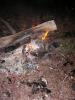
 Camp fire on Red Rock Island
Taken on 2008-03-27 .
Links to related images: Date. Proofs. Map. Story.
 John Boeschen packing up to leave Red Rock Island
Taken on 2008-03-27 .
Links to related images: Date. Proofs. Map. Story.
 Dave Brown packing up to leave Red Rock Island
Taken on 2008-03-27 .
Links to related images: Date. Proofs. Map. Story.
 John Boeschen packing up to leave Red Rock Island
Taken on 2008-03-27 .
Links to related images: Date. Proofs. Map. Story.
 Ninja Camping on Red Rock Island
Taken on 2008-03-27 .
Links to related images: Date. Proofs. Map. Story.
 The intrepid kayaker preparing brussel sprouts on Red Rock Island
Taken on 2008-03-27 .
Links to related images: Date. Proofs. Map. Story.
 Approaching Red Rock Island
Taken on 2008-03-9 .
Links to related images: Date. Proofs. Map. Story.
 Short break on Red Rock Island
Taken on 2008-03-9 .
Links to related images: Date. Proofs. Map. Story.
 Richard Pieper and Paula Hubbard between the Brother Islands
Taken on 2008-03-9 .
Links to related images: Date. Proofs. Map. Story.
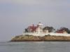
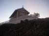
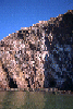
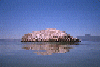
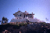
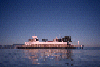
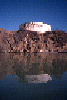
 Lighthouse on East Brother Island
Taken on 2008-03-9 .
Links to related images: Date. Proofs. Map. Story.
 West Brother Island
Taken on 2008-03-9 .
Links to related images: Date. Proofs. Map. Story.
 Dave Littlejohn at the West Sister Island
Taken on 2008-03-9 .
Links to related images: Date. Proofs. Map. Story.
 The inrepid kayaker napping near Red Rock
Taken on 2008-02-18 .
Links to related images: Date. Proofs. Map. Story.
 Passing The Brother Islands on the way north
Taken on 2008-02-18 .
Links to related images: Date. Proofs. Map. Story.
 Gordon Schanck between The Brother Islands on the way south
Taken on 2008-02-18 .
Links to related images: Date. Proofs. Map. Story.

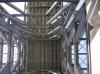
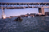
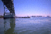
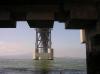 Under a tower of the Richmond / San Rafael Bridge
Taken on 2008-02-18 .
Links to related images: Date. Proofs. Map. Story.
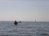
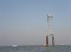 Don Fleming at the channel marker in San Pablo Bay
Taken on 2008-02-16 .
Links to related images: Date. Story.
 Paula Hubbard and Rich Pieper in the middle of San Pablo Bay
Taken on 2008-02-16 .
Links to related images: Date. Story.
 Fred Cooper in the middle of San Pablo Bay
Taken on 2008-02-16 .
Links to related images: Date. Story.
 Don Fleming in the middle of San Pablo Bay
Taken on 2008-02-16 .
Links to related images: Date. Story.
 Fred, Paula and Rich in the middle of San Pablo Bay
Taken on 2008-02-16 .
Links to related images: Date. Story.
 Don Fleming approaching the last channel marker in San Pablo Bay
Taken on 2008-02-16 .
Links to related images: Date. Proofs. Map. Story.
 Ferry boat passing the Brother Islands
Taken on 2008-02-16 .
Links to related images: Date. Proofs. Map. Story.

 Approaching the Brother Islands
Taken on 2008-02-16 .
Links to related images: Date. Proofs. Map. Story.
 Don Fleming and Paula leaving Red Rock
Taken on 2008-02-16 .
Links to related images: Date. Proofs. Map. Story.
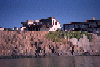
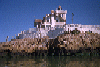
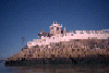
 East Brother Lighthouse in the morning
Taken on 2007-12-21 .
Links to related images: Date. Proofs. Map.
 Tide rip in front of West Brother Island
Taken on 2007-12-21 .
Links to related images: Date. Proofs. Map.
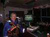 John Boeschen in Heaven: Beer, chocolate and Footbal TV
Taken on 2007-12-20 .
Links to related images: Date. Proofs. Map. Story.
 Patch of bunker oil spill on Red Rock Island
Taken on 2007-11-21 .
Links to related images: Date. Proofs. Map.
 Leaving Red Rock Island in the morning
Taken on 2007-11-21 .
Links to related images: Date. Proofs. Map.
 The Mayor approaching Red Rock Island at sunset
Taken on 2007-11-20 .
Links to related images: Date. Proofs. Story.
 John Boeschen, The Mayor and Indiana hanging out on Red Rock Island
Taken on 2007-11-20 .
Links to related images: Date. Proofs. Map. Story.
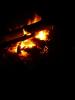 Campfire on Red Rock Island
Taken on 2007-11-20 .
Links to related images: Date. Proofs. Map. Story.
 John Boeschen hanging out on Red Rock Island
Taken on 2007-11-20 .
Links to related images: Date. Proofs. Map. Story.

 John Boeschen,Indiana and The Mayor packing up to leave Red Rock Island
Taken on 2007-11-20 .
Links to related images: Date. Proofs. Map. Story.
 The lights of the kayaks drift off, leaving me behind
Taken on 2007-11-20 .
Links to related images: Date. Proofs. Map. Story.
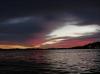
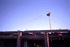
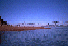
 Sunset skies over San Francisco Bay
Taken on 2007-11-15 .
Links to related images: Date. Proofs. Map. Story.
 I am featured in Old Man Boeschen's Comics
Taken on 2006-12-28 .
Links to related images: Date. Proofs. Map. Story.
 The 'Gonzo Bay Tour' went around Red Rock.
Taken on 1999-01-31 .
Links to related images: Date. Proofs. Map. Story.
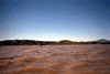
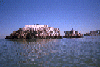
 Pablo Point
Taken on 1997-10-3 .
Links to related images: Date. Proofs. Map.
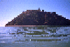
 Dump pyramid
Taken on 1997-10-3 .
Links to related images: Date. Proofs. Map.
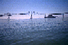
 Duck blind
Taken on 1997-10-3 .
Links to related images: Date. Proofs. Map.
 nappers distant
Taken on 1997-07-13 .
Links to related images: Date. Proofs. Map. Story.
 more nappers
Taken on 1997-07-13 .
Links to related images: Date. Proofs. Map. Story.
 BASKers basking on the cystern on East Brother Island
Taken on 1997-07-13 .
Links to related images: Date. Proofs. Map. Story.
 Me, dog and Don Flemming on East Brother Island
Taken on 1997-07-13 .
Links to related images: Date. Proofs. Map. Story.
 boat landing
Taken on 1997-07-13 .
Links to related images: Date. Proofs. Map. Story.
 marin b/lighthouse
Taken on 1997-07-13 .
Links to related images: Date. Proofs. Map. Story.
 diablo b/lignthouse
Taken on 1997-07-13 .
Links to related images: Date. Proofs. Map. Story.
 down at cystern
Taken on 1997-07-13 .
Links to related images: Date. Proofs. Map. Story.
 down at E Brother
Taken on 1997-07-13 .
Links to related images: Date. Proofs. Map. Story.
 landing at Brother
Taken on 1997-07-13 .
Links to related images: Date. Proofs. Map. Story.
 Canadian G.
Taken on 1997-03-5 .
Links to related images: Date. Proofs. Map. Story.

 Castro Rocks in front of the Richmond Bridge
Taken on 1995-10-14 .
Links to related images: Date. Proofs. Map. Story.
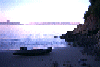 Kayak on Keller Beach late in the evening
Taken on 1995-10-14 .
Links to related images: Date. Proofs. Map. Story.
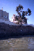
 Old personal boat ramp on Point Richmond
Taken on 1995-10-14 .
Links to related images: Date. Proofs. Map. Story.
 Flowering bushes on Point Richmond
Taken on 1995-10-14 .
Links to related images: Date. Proofs. Map. Story.
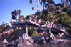 Incredible deck over water at Point Richmond
Taken on 1995-10-14 .
Links to related images: Date. Proofs. Map. Story.
 Boathouse with red flowers on roof at Point Richmond
Taken on 1995-10-14 .
Links to related images: Date. Proofs. Map. Story.
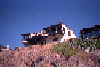
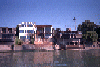
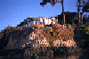
 Modern house above bluff at Point Richmond
Taken on 1995-10-14 .
Links to related images: Date. Proofs. Map. Story.
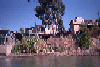
 Nice houses above water at Point Richmond
Taken on 1995-10-14 .
Links to related images: Date. Proofs. Map. Story.
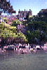
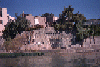 Stone terraces down to water at Point Richmond
Taken on 1995-10-14 .
Links to related images: Date. Proofs. Map. Story.
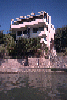 Modern house above the water at Point Richmond
Taken on 1995-10-14 .
Links to related images: Date. Proofs. Map. Story.
 Nice houses above water at Point Richmond
Taken on 1995-10-14 .
Links to related images: Date. Proofs. Map. Story.
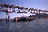
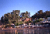
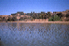
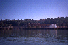
 Point Richmond houses from farther ofshore
Taken on 1995-10-14 .
Links to related images: Date. Proofs. Map. Story.
 Sail boats going around supertanker
Taken on 1995-10-14 .
Links to related images: Date. Proofs. Map. Story.
 Sailboat between me and Red Rock Island
Taken on 1995-10-14 .
Links to related images: Date. Proofs. Map. Story.
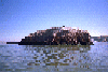
 Tugboat pushing barge quickly past me
Taken on 1995-10-14 .
Links to related images: Date. Proofs. Map. Story.
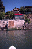
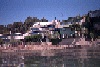
 Funky beach houses at Point Richmond
Taken on 1995-10-14 .
Links to related images: Date. Proofs. Map. Story.
 Desiner house above rocky Point Richmond shoreline
Taken on 1995-10-14 .
Links to related images: Date. Proofs. Map. Story.
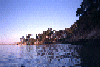 Evening light on Point Richmond shorefront houses
Taken on 1995-10-14 .
Links to related images: Date. Proofs. Map. Story.
 Approaching Red Rock Island
Taken on 1995-10-14 .
Links to related images: Date. Proofs. Map. Story.
 The view from the beach on Red Rock Island
Taken on 1995-10-14 .
Links to related images: Date. Proofs. Map. Story.
 The view from inside the cave on the east side of Red Rock Island
Taken on 1995-10-14 .
Links to related images: Date. Proofs. Map. Story.
 The San Rafael Bridge viewed from the flag at the top of Red Rock Island
Taken on 1995-10-14 .
Links to related images: Date. Proofs. Map. Story.
 Sailboat under the San Rafael Bridge from the top of Red Rock Island
Taken on 1995-10-14 .
Links to related images: Date. Proofs. Map. Story.
 The south end of Red Rock Island viewed from the top
Taken on 1995-10-14 .
Links to related images: Date. Proofs. Map. Story.
 The beach on the north end of Red Rock Island viewed from the top
Taken on 1995-10-14 .
Links to related images: Date. Proofs. Map. Story.
 Yerba Buena, San Francisco, Angel Island and Tiburon from the top of Red Rock Is
Taken on 1995-10-14 .
Links to related images: Date. Proofs. Map. Story.
 Mount Tam viewed from the top of Red Rock Island
Taken on 1995-10-14 .
Links to related images: Date. Proofs. Map. Story.
 Richmond viewed from the top of Red Rock Island
Taken on 1995-10-14 .
Links to related images: Date. Proofs. Map. Story.
 The east side of Red Rock Island viewed from the top
Taken on 1995-10-14 .
Links to related images: Date. Proofs. Map. Story.
 Richmond Bridge viewed through rocks on the shore of Red Rock Island
Taken on 1995-10-14 .
Links to related images: Date. Proofs. Map. Story.

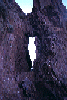 Looking through the small arch on the north end of Red Rock Island
Taken on 1995-10-14 .
Links to related images: Date. Proofs. Map. Story.
 The junk piled on the north end of Red Rock Island
Taken on 1995-10-14 .
Links to related images: Date. Proofs. Map. Story.
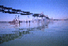
 Launching from Point Molate Park
Taken on 1995-10-2 .
Links to related images: Date. Proofs. Map. Story.
 Going under the Richmond - San Rafael Bridge
Taken on 1995-10-2 .
Links to related images: Date. Proofs. Map. Story.
 Landed on the red sand beach on Red Rock Island
Taken on 1995-10-2 .
Links to related images: Date. Proofs. Map. Story.
 Circumnavigating Red Rock Island
Taken on 1995-10-2 .
Links to related images: Date. Proofs. Map. Story.
 Leaving Red Rock Island
Taken on 1995-10-2 .
Links to related images: Date. Proofs. Map. Story.
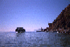
 Red Rock Island and the bridge
Taken on 1995-10-2 .
Links to related images: Date. Proofs. Map. Story.
 West and East Brother Islands
Taken on 1995-10-2 .
Links to related images: Date. Proofs. Map. Story.
 West Brother Island
Taken on 1995-10-2 .
Links to related images: Date. Proofs. Map. Story.
 East Brother Island
Taken on 1995-10-2 .
Links to related images: Date. Proofs. Map. Story.
 West Brother Island
Taken on 1995-10-2 .
Links to related images: Date. Proofs. Map. Story.
 East Brother Island
Taken on 1995-10-2 .
Links to related images: Date. Proofs. Map. Story.
 West and East Brother Islands
Taken on 1995-10-2 .
Links to related images: Date. Proofs. Map. Story.
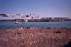
 Molasses tank on the Richmond shoreline
Taken on 1995-10-2 .
Links to related images: Date. Proofs. Map. Story.
 Pocket Beach on the Richmond shoreline
Taken on 1995-10-2 .
Links to related images: Date. Proofs. Map. Story.
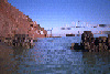
 Brick castle on the Richmond shoreline
Taken on 1995-10-2 .
Links to related images: Date. Proofs. Map. Story.
 Richmond - San Rafael Bridge viewed past the Richmond Shoreline
Taken on 1995-10-2 .
Links to related images: Date. Proofs. Map. Story.
All text and images Copyright © 1995 by Mike Higgins / contact