The following images were all taken near the same location, ~26.21535/111.37714:
Click on the small images to see the full-sized ones.
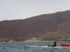
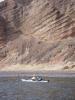 Herb Howe in front of sandstone cliffs
Taken on 2007-04-8 .
Links to related images: Date. Proofs. Map. Story.
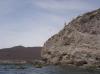
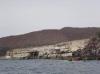
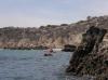
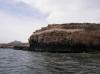
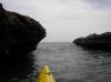
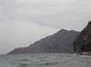
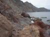
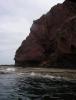
 Cliffs south of Punta el Mangle
Taken on 2007-04-8 .
Links to related images: Date. Proofs. Map. Story.

 Herb Howe in front of sandstone cliffs
Taken on 2007-04-8 .
Links to related images: Date. Proofs. Map. Story.
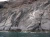
 Cliffs south of Punta el Mangle
Taken on 2007-04-8 .
Links to related images: Date. Proofs. Map. Story.
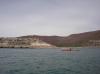
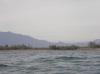
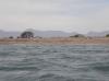
 A panorama of Ensenada el Mangle
Taken on 2007-04-8 .
Links to related images: Date. Proofs. Map. Story.
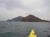
 Kate Deslauriers in front of Ensenada el Mangle
Taken on 2007-04-8 .
Links to related images: Date. Proofs. Map. Story.
 Doug Hamilton in front of Ensenada el Mangle
Taken on 2007-04-8 .
Links to related images: Date. Proofs. Map. Story.
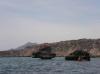
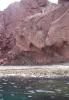
 Rock formations south of Ensenada el Mangle
Taken on 2007-04-8 .
Links to related images: Date. Proofs. Map. Story.
 Doug Hamilton approaching fossil beach
Taken on 2007-04-8 .
Links to related images: Date. Proofs. Map. Story.
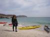
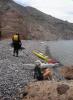
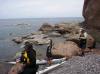
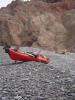
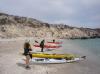 Everyone landed for a brake at fossil beach
Taken on 2007-04-8 .
Links to related images: Date. Proofs. Map. Story.
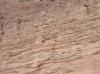
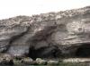
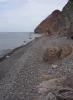
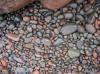
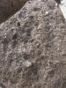 Why we named it Fossil beach
Taken on 2007-04-8 .
Links to related images: Date. Proofs. Map. Story.
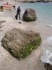 Doug Hamilton on Fossil Beach
Taken on 2007-04-8 .
Links to related images: Date. Proofs. Map. Story.
 Kate DesLauriers on Fossil Beach
Taken on 2007-04-8 .
Links to related images: Date. Proofs. Map. Story.
 Rock formations south of Ensenada el Mangle
Taken on 2007-04-8 .
Links to related images: Date. Proofs. Map. Story.
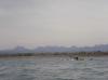
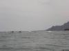
 Looking ahead to Isla Coronados
Taken on 2007-04-8 .
Links to related images: Date. Proofs. Map. Story.
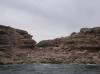
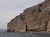
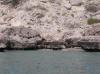
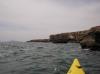
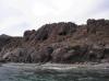
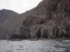
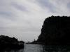
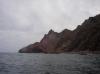
 Cliffs and caves south of Ensenada el Mangle
Taken on 2007-04-8 .
Links to related images: Date. Proofs. Map. Story.
 Cliffs and caves north of Loreto
Taken on 2007-04-8 .
Links to related images: Date. Proofs. Map. Story.
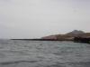
 Shallow water in front of the Boca los Batequas
Taken on 2007-04-8 .
Links to related images: Date. Proofs. Map. Story.
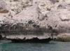
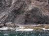
 Locals camping out near the Boca los Batequas
Taken on 2007-04-8 .
Links to related images: Date. Proofs. Map. Story.
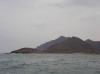
 The start of the cliffs north of Loreto
Taken on 2007-04-8 .
Links to related images: Date. Proofs. Map. Story.
 Osprey nest on the cliffs north of Loreto
Taken on 2007-04-8 .
Links to related images: Date. Proofs. Map. Story.
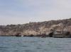
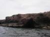
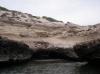
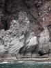
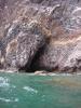 Cave in the cliffs north of Loreto
Taken on 2007-04-8 .
Links to related images: Date. Proofs. Map. Story.
 Rock gardening north of Loreto
Taken on 2007-04-8 .
Links to related images: Date. Proofs. Map. Story.
 Everyone stopping for a break north of Loreto
Taken on 2007-04-8 .
Links to related images: Date. Proofs. Map. Story.
 Break beach north of Loreto
Taken on 2007-04-8 .
Links to related images: Date. Proofs. Map. Story.
 Doug Hamilton's kayak haning out at break beach
Taken on 2007-04-8 .
Links to related images: Date. Proofs. Map. Story.
 Rock gardening north of Loreto
Taken on 2007-04-8 .
Links to related images: Date. Proofs. Map. Story.
 Don Fleming close to shore north of Loreto
Taken on 2007-04-8 .
Links to related images: Date. Proofs. Map. Story.
 Kate DesLauriers north of Loreto
Taken on 2007-04-8 .
Links to related images: Date. Proofs. Map. Story.

 Paddling close to shore north of Loreto
Taken on 2007-04-8 .
Links to related images: Date. Proofs. Map. Story.
 Kate DesLauriers north of Loreto
Taken on 2007-04-8 .
Links to related images: Date. Proofs. Map. Story.
 Paddling close to shore north of Loreto
Taken on 2007-04-8 .
Links to related images: Date. Proofs. Map. Story.
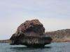
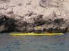 The intrepid kayaker rock gardening in Baja
Taken on 2007-04-8 .
Links to related images: Date. Proofs. Map. Story.
All text and images Copyright © 2007 by Mike Higgins / contact