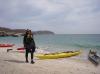
Punta Mendenares to Arroyo de la Viper, April 8th 2007.
Click on the small image to see the full-sized one.
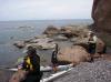
 The second scorpion I have seen in all of Baja
Links to related images: Nearby. Proofs. Map.
Approximate location: 26.32142N / 111.38622W.
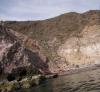
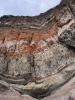
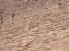
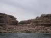
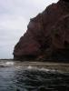
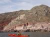 Doug Hamilton in front of red cliffs
Links to related images: Nearby. Proofs. Map.
Approximate location: 26.31783N / 111.38703W.
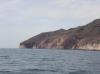
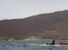
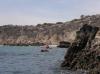
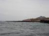
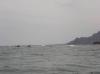
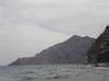
 Approaching Punta el Mangle
Links to related images: Nearby. Proofs. Map.
Approximate location: 26.30258N / 111.38476W.

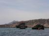
 Rounding Punta el Mangle
Links to related images: Nearby. Proofs. Map.
Approximate location: 26.30131N / 111.38339W.
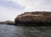
 Bird shit towers on Punta el Mangle
Links to related images: Nearby. Proofs. Map.
Approximate location: 26.30136N / 111.38311W.
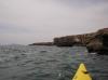
 Rounding Punta el Mangle
Links to related images: Nearby. Proofs. Map.
Approximate location: 26.30009N / 111.38261W.
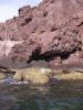
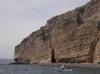
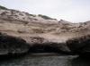
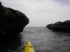
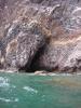
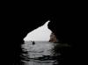 Doug Hamilton entering large cave near Punta el Mangle
Links to related images: Nearby. Proofs. Map.
Approximate location: 26.3003N / 111.38276W.
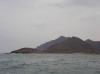
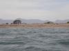
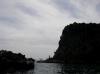
 Approaching Isla Cononados
Links to related images: Nearby. Proofs. Map.
Approximate location: 26.29977N / 111.38233W.
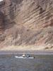
 Doug Hamilton south of Punta el Mangle
Links to related images: Nearby. Proofs. Map.
Approximate location: 26.29977N / 111.38233W.
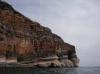
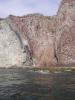
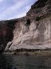
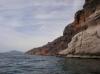
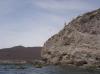
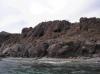
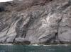
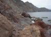
 Cliffs south of Punta el Mangle
Links to related images: Nearby. Proofs. Map.
Approximate location: 26.29777N / 111.38251W.
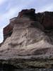
 Herb Howe in front of sandstone cliffs
Links to related images: Nearby. Proofs. Map.
Approximate location: 26.28696N / 111.38261W.
 Cliffs south of Punta el Mangle
Links to related images: Nearby. Proofs. Map.
Approximate location: 26.28696N / 111.38261W.

 Herb Howe in front of sandstone cliffs
Links to related images: Nearby. Proofs. Map.
Approximate location: 26.28462N / 111.38253W.
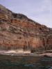
 Cliffs south of Punta el Mangle
Links to related images: Nearby. Proofs. Map.
Approximate location: 26.28033N / 111.38274W.
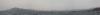 A panorama of Ensenada el Mangle
Links to related images: Nearby. Proofs. Map.
Approximate location: 26.28013N / 111.38283W.
 Kate Deslauriers in front of Ensenada el Mangle
Links to related images: Nearby. Proofs. Map.
Approximate location: 26.26391N / 111.39401W.
 Doug Hamilton in front of Ensenada el Mangle
Links to related images: Nearby. Proofs. Map.
Approximate location: 26.26093N / 111.39536W.
 Rock formations south of Ensenada el Mangle
Links to related images: Nearby. Proofs. Map.
Approximate location: 26.25754N / 111.39746W.
 Doug Hamilton approaching fossil beach
Links to related images: Nearby. Proofs. Map.
Approximate location: 26.25754N / 111.39746W.
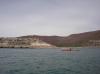
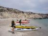 Everyone landed for a brake at fossil beach
Links to related images: Nearby. Proofs. Map.
Approximate location: 26.25584N / 111.39763W.
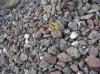
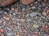
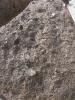 Why we named it Fossil beach
Links to related images: Nearby. Proofs. Map.
Approximate location: 26.25584N / 111.39763W.
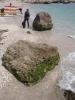 Doug Hamilton on Fossil Beach
Links to related images: Nearby. Proofs. Map.
Approximate location: 26.25584N / 111.39763W.
 Kate DesLauriers on Fossil Beach
Links to related images: Nearby. Proofs. Map.
Approximate location: 26.25584N / 111.39761W.
 Rock formations south of Ensenada el Mangle
Links to related images: Nearby. Proofs. Map.
Approximate location: 26.24732N / 111.39137W.
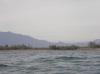
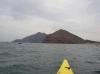
 Looking ahead to Isla Coronados
Links to related images: Nearby. Proofs. Map.
Approximate location: 26.24732N / 111.39137W.
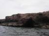
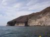
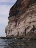
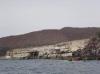
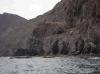
 Cliffs and caves south of Ensenada el Mangle
Links to related images: Nearby. Proofs. Map.
Approximate location: 26.22462N / 111.383W.
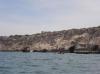
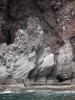
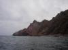
 Cliffs and caves north of Loreto
Links to related images: Nearby. Proofs. Map.
Approximate location: 26.2246N / 111.38311W.
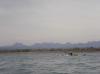
 Shallow water in front of the Boca los Batequas
Links to related images: Nearby. Proofs. Map.
Approximate location: 26.22106N / 111.3789W.
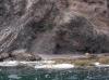
 Locals camping out near the Boca los Batequas
Links to related images: Nearby. Proofs. Map.
Approximate location: 26.21535N / 111.37714W.
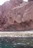
 The start of the cliffs north of Loreto
Links to related images: Nearby. Proofs. Map.
Approximate location: 26.2025N / 111.37669W.
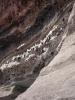
 Osprey nest on the cliffs north of Loreto
Links to related images: Nearby. Proofs. Map.
Approximate location: 26.20143N / 111.37676W.
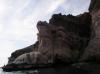
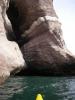
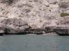
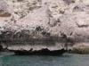
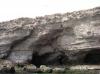
 Cave in the cliffs north of Loreto
Links to related images: Nearby. Proofs. Map.
Approximate location: 26.20005N / 111.37746W.
 Rock gardening north of Loreto
Links to related images: Nearby. Proofs. Map.
Approximate location: 26.18327N / 111.37474W.
 Everyone stopping for a break north of Loreto
Links to related images: Nearby. Proofs. Map.
Approximate location: 26.17523N / 111.36579W.
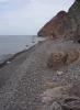
 Break beach north of Loreto
Links to related images: Nearby. Proofs. Map.
Approximate location: 26.17523N / 111.36581W.
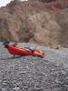 Doug Hamilton's kayak haning out at break beach
Links to related images: Nearby. Proofs. Map.
Approximate location: 26.17523N / 111.36581W.
 Rock gardening north of Loreto
Links to related images: Nearby. Proofs. Map.
Approximate location: 26.17445N / 111.36399W.
 Don Fleming close to shore north of Loreto
Links to related images: Nearby. Proofs. Map.
Approximate location: 26.16815N / 111.36092W.
 Kate DesLauriers north of Loreto
Links to related images: Nearby. Proofs. Map.
Approximate location: 26.1587N / 111.35948W.

 Paddling close to shore north of Loreto
Links to related images: Nearby. Proofs. Map.
Approximate location: 26.14939N / 111.35783W.
 Kate DesLauriers north of Loreto
Links to related images: Nearby. Proofs. Map.
Approximate location: 26.1457N / 111.35725W.


 Paddling close to shore north of Loreto
Links to related images: Nearby. Proofs. Map.
Approximate location: 26.13351N / 111.35405W.


 The last arroyo beach before the congestion of Loreto
Links to related images: Nearby. Proofs. Map.
Approximate location: 26.12684N / 111.35109W.
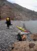
 Camping on the last arroyo beach before the congestion of Loreto
Links to related images: Nearby. Proofs. Map.
Approximate location: 26.12684N / 111.35109W.
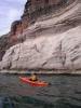
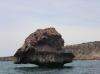
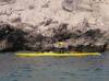 The intrepid kayaker rock gardening in Baja
Links to related images: Nearby. Proofs. Map.
Approximate location: 26.18179N / 111.37317W.
All text and images Copyright © 2007 by Mike Higgins / contact