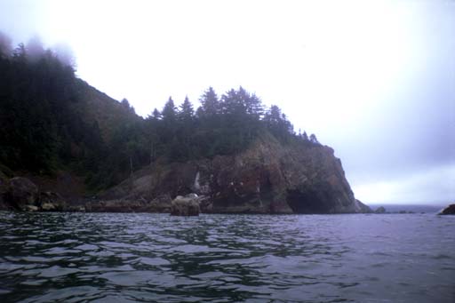
I got up at 6:00 AM so I could try to get an early start. did make it on the water by 8:30. I paddled all the way around False Klamath Rock, looking for caves. One hopeful spot turned out to be a notch in the rock that I was able to back into. Then I started south going behind the rocks and taking my time. Chris had told me about a sea lion colony south of the hostel, and I heard them barking. I only saw one sea lion up on the rocks and perhaps another dozen in the water. Nothing compared to the hundreds of them on the rocks northwest of Crescent City. What I did find were dozens of harbor seals hauled out on the rocks. I tried to go around, sometimes working hard to get through rough spaces, but they usually spooked into the water anyway.
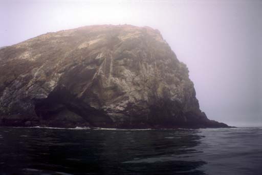
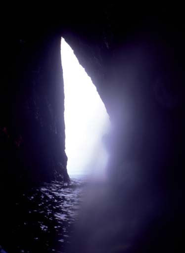
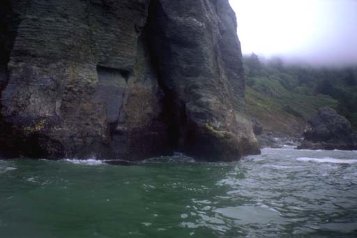
As I rounded the point before the Klamath River, I found a large rock with a big curved dent in it, like an amphitheater. Near the waterline the curve broke into separate columns with caves between them. Some of the caves were mere cracks and others were large enough to turn a kayak around it. From the light and surge I could tell that some of them connected across to each other. But most of them were too rough, even on a 3 foot swell day, to paddle into. The one on the far right showed sunlight. It was an arch that lead 20 meters through to the other side of the rock. As I drifted farther under the overhang this arch was exposed more and more until I could see it was wide enough to paddle through. Which I did.
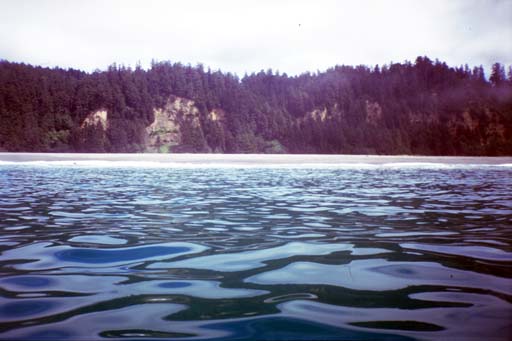
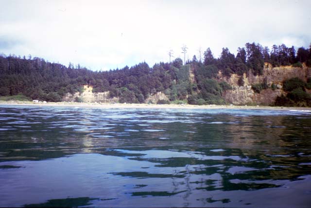
Continuing south I could see the long beach in front of the Klamath River. I hugged the rocky north shore looking for another cave I thought I saw from the road on my scouting trip the day before. What I found was a wedge shaped piece of extruded rock that had looked like a dent due to an optical illusion. I turned out to sea to cut across the mouth of the river and the long sandy spit.
Sprinting across open water I looked p and saw a row of cars and RV's where I had seen some people watching whales the day before. I figured these whales would be too far out to sea for me so I didn't alter my course. But then I saw a spout ahead of me. I altered course to head towards it and looked around. A Whale spouted west of me and dove with flukes up. Another mottled head cam up to spout and identified itself as a gray whale. I tried to take some pictures but assume they will show the usual fuzzy gray lump on a fuzzy gray sea. I started to continue on my way when the first one I had headed towards came up and exhaled 30 meters from me. I got a few good views (no pictures) of him before he dove again, then I turned my back on the whales to continue sprinting for the next point.
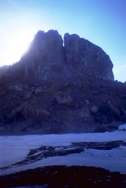
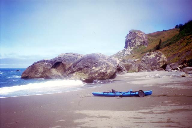
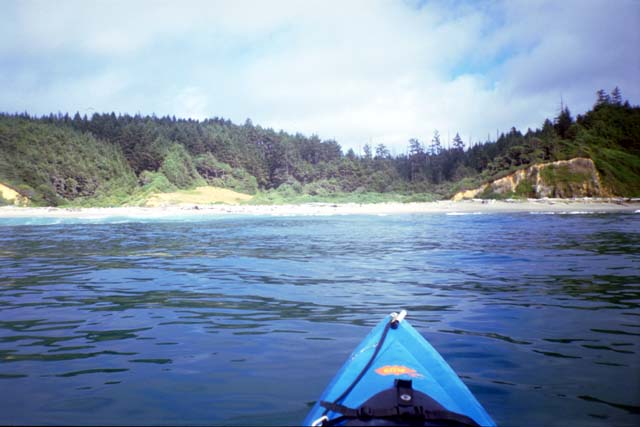
I went around Flattop Rock Point and played in the rock gardens towards Split Rock. I found out where it got it's name when I arrived at the correct angle to see though a crack right down the middle of the rock. I needed to change film in my camera so I started looking for a place to stop for lunch. I found a neat little beach with offshore rocks that the waves wrapped around. Onshore was a row of large rocks protecting a wide beach with berms at the back against the cliff. A good place to camp I thought.
I launched after lunch and soon came to the valley that indicated Johnson's Creek and the Del Norte/Humbolt County border. I still can't find those dotted lines they show on the maps. But now it was halfway through Friday and I had paddled all of Del Norte County since Monday morning!
My charts show a rocky point south of Johnson's Creek but the large sandy Gold Bluff Beach has grown to extend around the point. The beach was very steep and the waves dumped directly onto the sand. I found a place between two rocks where I thought I might land on my return trop tomorrow. But I continued on into Humbolt County.
Paddling down the 14 kilometer long Gold Bluff Beach I played a game of "land/don't land" while watching the surf. I wanted to know if I could land (and launch) here if I had to. For the first third of the beach, it did not match the topography I had seen on my scouting trip. Then I had seen a wide shelf of flat dunes between the bluff and the water. Here there was a wide gap between the bluff and the water, but I could not see dune grass or anything else growing on top. For all I knew, there was a lagoon on the other side of the sandy beach. Fishermen drove up and down this beach in pickup trucks and stopped to cast lines into the surf.
Finally I got to Fern Creek and started seeing the dunes I expected. I could also see the tent city that is the legal campground on this beach. I couldn't imagine wanting to cram myself in there so I kept paddling. The first third of the beach I had paddled within 10 meters of shore, watching the waves dump. But after Fern Creek, large waves started rising up far from shore and scaring me. I would watch one large wave go under me, then another and another, each larger than the last. I'd relax figuring these things come in threes. But two more even larger ones would rise up and threaten to dump on me! I ended up 100 meters or more from shore, presumably driven there by offshore sandbars that made the waves rise up.
At one point a hundred little fish jumped out of the water in front of me, like large raindrops trying to leap back into the sky. I stopped paddling and they disappeared. Then when I started moving again they jumped out again, apparently in a hurry to get away from whatever they thought I was. At another time I saw a sea lion swimming up the coast in the other direction. He would porpoise his whole body out of the water. Exuberation? Between two of these jumps I slapped the water with my paddle trying to get his attention. But he continued north oblivious of my presence.
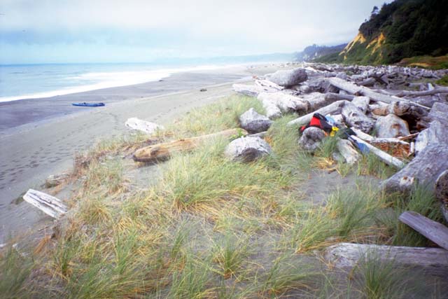
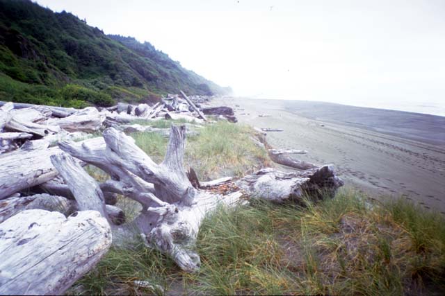
I had originally planned to stop on Gold Bluff Beach, but my chart showed a small beach around the next rock, Mussel Point, at the end of this beach. It would make this a long day (32 kilometers) and there was no guarantee I could camp there. I might have to turn back to the end of Gold Bluff Beach anyway and put in even more kilometers. So when I saw an inviting looking valley hear the end of the beach I turned in for the day. I found a channel between two offshore sandbars and made an easy landing My valley is kilometers south of the road and the ranger but I dragged my boat up onto the edge of the dune behind a driftwood log. From up here I could see a fisherman kilometers north of me and a couple on the beach kilometers south. Almost solitude.