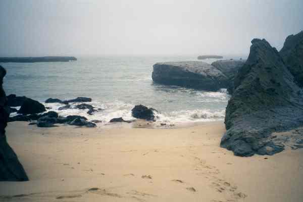
The narrow slot of sand I landed on the day before was mostly blocked by rocks in the low tide of morning. I think I could have launched between the rocks but the water was really squirrelly. Waves sloshed against the big rock and surged back over the little ones. I didnt want my boat pushed sideways like that. Instead, I set up on the end of the steep part of the beach, just the other side of the big rock that I had landed behind. Over breakfast I watched this area and decided that it was almost a soup zone at low tide (instead of a dumping zone like it was at high tide). There were more large rocks offshore to go out between and one large one far off shore where I could see the waves seventeen seconds before they hit the beach.
I got into my boat with it teetering at the top of the steep part of the beach. When I tilted over the edge the boat couldnt quite keep momentum unless I shoved continuously with hand and paddle. I stopped half way down and waited for a medium sized wave to come in. Then I slid the rest of the way down the sand berm to meet the wave. Lubricated by the water sloshing up, my boat picked up speed and shot out into the waves effortlessly. I climbed over the next wave and discovered the hard way that I had forgotten to close the neck seal on my paddling jacket. No time to fix it, I had to paddle hard into an even bigger wave rising steeply over a submerged rock! Another face-full of cold water, more water down my neck and I was safe out into deep water. I also discovered that I forgot to screw my front hatch down all the way. This small screw-in hatch is barely large enough to put my arm through to arrange the load. I kept forgetting small last minute items, opening that hatch, stuffing something in then closing it before finding something else again. So I left it half screwed down to save time. It was too far to reach my hand forward to it and I was unable to turn it by pushing with my paddle. I figured it wouldnt leak much if I stayed out of rough water. (By the end of the day there was a liter or two of water in the boat, which is OK). I turned left and went behind Seal Rock for starters.
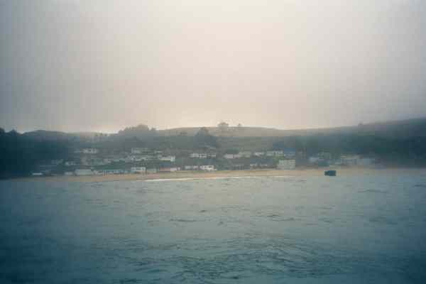
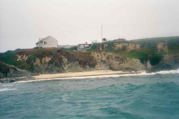
The next interesting spot on my chart was a little rock guarded cove called Martins Beach. This turned out to harbor a little community by the same name. It reminds me of Shelter Cove near Pacifica. I dared myself to surf between several of the larger rocks here and paddle through a rock garden. Isnt this why I'm doing this trip in my Coaster kayak? On the way back out of the rock garden I disturbed a colony of harbor seals that I came upon suddenly. I said "sorry guys" but they all jumped into the water.
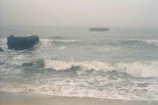
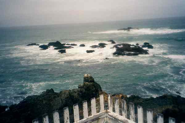
The next 10 kilometers was marked on my charts (by John Lull) as having bad dumping surf so I dug in and paddled past it all. I didnt have room in my chart case for all the pages for today, so I left out most of it. I noted a few landmarks, like bridges on highway one, so I would know when to start using the next chart. Sooner than I expected I found myself in the next chart at Pescadero State Beach. After this was Pescadero Point which had a small offshore rock I could hardly see on my chart. Inside of that waves seemed to be breaking everywhere. As I headed towards this rock a large set broke offshore from me, re-formed under me, and then broke just past me again! My visible rock is apparently the one visible part of an extensive offshore reef! I turned and went in-shore of the rock to avoid the outer reef and nervously kept my eye out for foamy patches ahead that indicated parts of the inner reef. None of this reef system showed up on my chart, which is based on USGS topographic maps. ("Caution: Not for Navigation"). I prefer topographic maps because they show the topology of the shore cliffs and allow me to figure out where I am. Perhaps I should have combined information from nautical charts. I dont have an excuse since I own digital copies of the nautical charts.
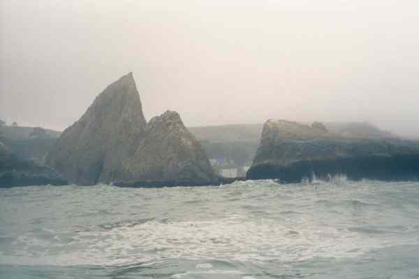
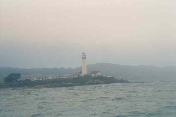
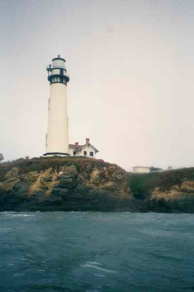
From this reef I caught the flash of the Pigeon Point Lighthouse! It was sticking up above the middle of a bluff. Why didnt they put it on the point? I passed Bean Hollow State Beach, which had a very nice little protected cove that looked easy to land on. As I paddled farther south the lighthouse marched west until it was standing on a point past the bluff I first saw it above. One more point and two more kilometers I had to paddle. Drops of water on my chart hid from me the fact that Pigeon Point had a big rock-strewn reef in front of it. I also had to discover that by paddling around it.
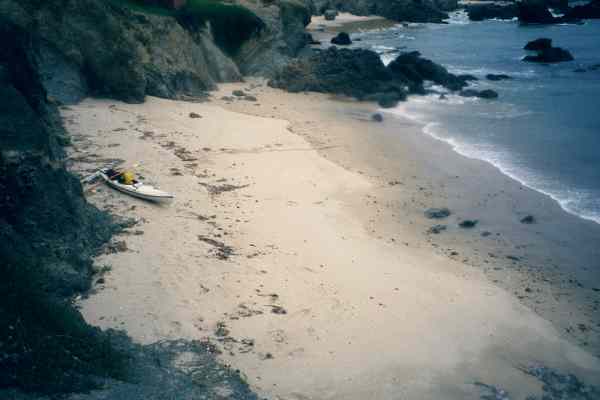
I had been letting myself stop for a rest every hour when my digital watch chimed. It chimed 12:00 noon just as I approached the reef in front of the lighthouse. I decided to take a break, drink some water and eat at least some of my lunch before braving the point. This worked well! With some trail mix in my system the boat surged forward energetically when I picked up the paddle again. I zoomed up to the reef and took a series of pictures as I went around the point. I marveled at how fast the scenery started scrolling by every time I started paddling again. Soon I was behind the lighthouse and inside the protection of that reef. I enjoyed slowly cruising the back side of the point until I found the protected beach marked on my chart.
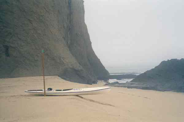
After pulling my boat up above the tide line I hiked up a meager trail and found myself inside a chain link fence with a half a dozen cabins under construction. I followed the fence around looking for an opening. One of the signs on the fence was loose enough to pry it out and read the other side "Construction Zone. Keep Out". But like Pete Seeger says, my side of the signs didn't say anything at all. Eventually I found a cute 1 meter high picket fence and stepped out of The Zone. I scoped out the Youth Hostel (closed until 4:30 PM as I expected) and hiked all the trails around the lighthouse. I used up the last few pictures on a roll of film so I could re-load for tomorrow while on dry land. I stopped at a bench to finish lunch with a view of the ocean to the south. None of the tourists seemed to find it strange that I was wearing booties, a wetsuit, spray skirt, and a paddle jacket. At least I didnt see anyone staring at me.
I went back into the Keep Out Zone, moved my boat up to a shelf above the beach and sorted my gear. Most went back into the boat while my "luggage" went up to the picnic tables. I changed into dry clothes and draped the wet ones all over a picnic table. I resisted the urge to hang my dive socks and Speedo shorts over the pickets of the fence. I spent a few hours writing in my journal (as you see) and finishing my trashy murder mystery. Im going to need another book and I didnt pack one!