The following images were all taken near the same location, ~44.780860281315/124.07315254211:
Click on the small images to see the full-sized ones.
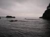
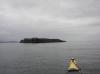
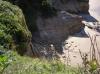
 Surfers paddle up to Dick Ryon in the morning
Taken on 2007-08-12 .
Links to related images: Date. Proofs. Map. Story.
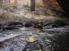
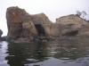
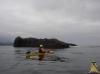
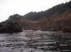 Dick Ryon rock gardening around Otter Crest
Taken on 2007-08-12 .
Links to related images: Date. Proofs. Map. Story.
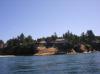
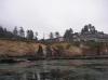 Buildingss between Otter Crest and Devils Punch Bowl
Taken on 2007-08-12 .
Links to related images: Date. Proofs. Map. Story.
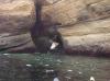
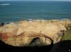
 Devils Punch Bowl at low tide
Taken on 2007-08-12 .
Links to related images: Date. Proofs. Map. Story.
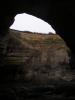
 Entering Devils Punch Bowl
Taken on 2007-08-12 .
Links to related images: Date. Proofs. Map. Story.
 People looking down at us inside Devils Punch Bowl
Taken on 2007-08-12 .
Links to related images: Date. Proofs. Map. Story.
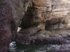 Inside Devils Punch Bowl
Taken on 2007-08-12 .
Links to related images: Date. Proofs. Map. Story.
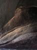
 Dick Ryon inside Devils Punch Bowl
Taken on 2007-08-12 .
Links to related images: Date. Proofs. Map. Story.

 Inside Devils Punch Bowl
Taken on 2007-08-12 .
Links to related images: Date. Proofs. Map. Story.
 South side of Devils Punch Bowl
Taken on 2007-08-12 .
Links to related images: Date. Proofs. Map. Story.
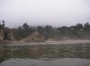 Calm beach south of Devils Punch Bowl
Taken on 2007-08-12 .
Links to related images: Date. Proofs. Map. Story.
 Dick Ryon and Dave Harry at Devils Punch Bowl
Taken on 2007-08-12 .
Links to related images: Date. Proofs. Map. Story.
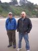 Dave Harry and Steve at Devils Punch Bowl
Taken on 2007-08-12 .
Links to related images: Date. Proofs. Map. Story.
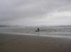 Surfer teaching a dog to surf
Taken on 2007-08-12 .
Links to related images: Date. Proofs. Map. Story.
 Otter Rock
Taken on 2007-08-12 .
Links to related images: Date. Proofs. Map. Story.
 Dick Ryon at Otter Rock
Taken on 2007-08-12 .
Links to related images: Date. Proofs. Map. Story.
 Low point near Boiler Bay
Taken on 2007-08-11 .
Links to related images: Date. Story.
 The outside of Depoe Bay
Taken on 2007-08-11 .
Links to related images: Date. Story.


 Calm sandy beach in Whale Cove
Taken on 2007-08-11 .
Links to related images: Date. Story.
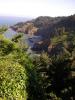
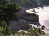
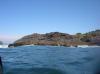 Low point near Cape Foulweather
Taken on 2007-08-11 .
Links to related images: Date. Proofs. Map. Story.
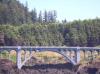 Highway 101 bridge ner Cape Foulweather
Taken on 2007-08-11 .
Links to related images: Date. Proofs. Map. Story.
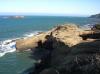
 Rough shore of Cape Foulweather
Taken on 2007-08-11 .
Links to related images: Date. Proofs. Map. Story.
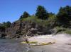
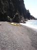 Kayaks landed on gravel beach at Cape Foulweather
Taken on 2007-08-11 .
Links to related images: Date. Proofs. Map. Story.


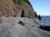
 Our gravel beach campsite on Cape Foulweather
Taken on 2007-08-11 .
Links to related images: Date. Proofs. Map. Story.
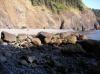
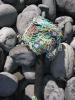 Flotsam on the beach at Cape Foulweather
Taken on 2007-08-11 .
Links to related images: Date. Proofs. Map. Story.
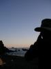 Dick Ryon in our Cape Foulweather camp in the evening
Taken on 2007-08-11 .
Links to related images: Date. Proofs. Map. Story.
 Our gravel beach campsite on Cape Foulweather
Taken on 2007-08-11 .
Links to related images: Date. Proofs. Map. Story.
 Sunset from our campsite on Cape Foulweather
Taken on 2007-08-11 .
Links to related images: Date. Proofs. Map. Story.

 Boiler Bay State Wayside
Taken on 2007-07-6 .
Links to related images: Date. Proofs. Map.
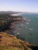
 Cape Foulweather looking south
Taken on 2007-07-6 .
Links to related images: Date. Proofs. Map.
 Cape Foulweather looking north
Taken on 2007-07-6 .
Links to related images: Date. Proofs. Map.
 Cape Foulweather looking south
Taken on 2007-07-6 .
Links to related images: Date. Proofs. Map.
 Looking back at Cape Fouweather from the south
Taken on 2007-07-6 .
Links to related images: Date. Proofs. Map.
 Devils Punch Bowl
Taken on 2007-07-6 .
Links to related images: Date. Proofs. Map.
 South of Devils Punch Bowl
Taken on 2007-07-6 .
Links to related images: Date. Proofs. Map.
All text and images Copyright © 2007 by Mike Higgins / contact