Punta Camalu to Isla San Martin, October 16th 2007.
Click on the small image to see the full-sized one.
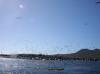
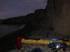 Packing up to leave Punta Camalu in the morning
Links to related images: Nearby. Proofs. Map.
Approximate location: 30.82178N / 116.08607W.
 Charles Harris doing a seal launch at Punta Camalu
Links to related images: Nearby. Proofs. Map.
Approximate location: 30.82094N / 116.0856W.
 The unfinished Punta Camalu hotel
Links to related images: Nearby. Proofs. Map.
Approximate location: 30.82066N / 116.08545W.
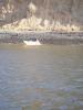
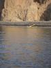 Gregg Berman doing a seal launch off Punta Camalu
Links to related images: Nearby. Proofs. Map.
Approximate location: 30.82066N / 116.08545W.
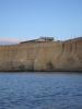
 Punta Camalu behind Gregg Berman
Links to related images: Nearby. Proofs. Map.
Approximate location: 30.80839N / 116.08W.
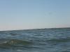
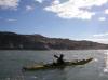 Gregg Berman passing the Vicente Guerrero point
Links to related images: Nearby. Proofs. Map.
Approximate location: 30.7379N / 116.04976W.
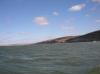
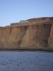
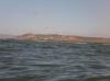
 Looking back towards Punta Camalu
Links to related images: Nearby. Proofs. Map.
Approximate location: 30.73779N / 116.04968W.
 Houses on the Vicente Guerrero point
Links to related images: Nearby. Proofs. Map.
Approximate location: 30.73779N / 116.04968W.
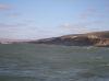
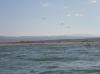
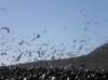
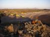
 These cinder cones mark San Quintin Bay ahead
Links to related images: Nearby. Proofs. Map.
Approximate location: 30.70932N / 116.04487W.
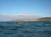
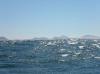
 The last cinder cone is Isla San Martin
Links to related images: Nearby. Proofs. Map.
Approximate location: 30.70932N / 116.04487W.
 Houses on the Vicente Guerrero point
Links to related images: Nearby. Proofs. Map.
Approximate location: 30.70932N / 116.04487W.
 A beach I had considered camping on, not so good
Links to related images: Nearby. Proofs. Map.
Approximate location: 30.70932N / 116.04487W.
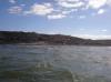
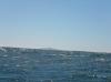
 Closer to San Quintin Bay
Links to related images: Nearby. Proofs. Map.
Approximate location: 30.61246N / 116.05395W.
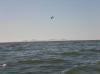
 And Closer to Isla San Martin
Links to related images: Nearby. Proofs. Map.
Approximate location: 30.61246N / 116.05395W.
 The natural breakwater on Isla San Martin
Links to related images: Nearby. Proofs. Map.
Approximate location: 30.48434N / 116.10008W.
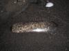
 Sand in a bottle buried in the sand
Links to related images: Nearby. Proofs. Map.
Approximate location: 30.48335N / 116.1057W.
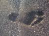 Charles Harris footprint in the sand
Links to related images: Nearby. Proofs. Map.
Approximate location: 30.4832N / 116.10525W.
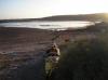 Our campsite in the lagoon on Isla San Martin
Links to related images: Nearby. Proofs. Map.
Approximate location: 30.48335N / 116.10549W.
All text and images Copyright © 2007 by Mike Higgins / contact