Punta Cantelmo to Punta Camalu, October 15th 2007,
Click on the small image to see the full-sized one.
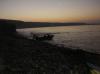 Panga fishermen going out early from Punta Cantelmo
Links to related images: Nearby. Proofs. Map.
Approximate location: 30.93394N / 116.24078W.
 Morning light at our campsite on Punta Cantelmo
Links to related images: Nearby. Proofs. Map.
Approximate location: 30.93394N / 116.24078W.
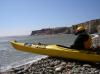
 Charles Harris doing the seal launch at Punta Cantelmo
Links to related images: Nearby. Proofs. Map.
Approximate location: 30.93329N / 116.24065W.

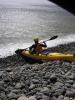
 Gregg Berman doing the seal launch at Punta Cantelmo
Links to related images: Nearby. Proofs. Map.
Approximate location: 30.93271N / 116.24042W.
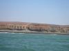
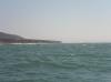
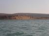 Punta San Jacinto
Links to related images: Nearby. Proofs. Map.
Approximate location: 30.91587N / 116.2237W.

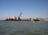
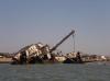 The shipwreck at Punta San Jacinto
Links to related images: Nearby. Proofs. Map.
Approximate location: 30.85997N / 116.16527W.
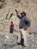
 Gregg Berman in front of Punta San Jacinto
Links to related images: Nearby. Proofs. Map.
Approximate location: 30.85997N / 116.16527W.

 Gregg Berman in front of the Punta San Jacinto shipwreck
Links to related images: Nearby. Proofs. Map.
Approximate location: 30.86012N / 116.16471W.
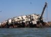 The shipwreck at Punta San Jacinto
Links to related images: Nearby. Proofs. Map.
Approximate location: 30.86012N / 116.16471W.
 Gregg Berman approaching Punta Camalu
Links to related images: Nearby. Proofs. Map.
Approximate location: 30.82697N / 116.11412W.
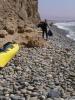
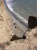
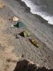
 Steep gravel beach inside Punta Camalu
Links to related images: Nearby. Proofs. Map.
Approximate location: 30.82026N / 116.08637W.
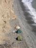
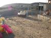
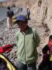 A local and his sons help us land and unpack our kayaks
Links to related images: Nearby. Proofs. Map.
Approximate location: 30.82159N / 116.08541W.
 Charles Harris carries gear to a better camping spot
Links to related images: Nearby. Proofs. Map.
Approximate location: 30.8218N / 116.0859W.
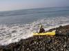
 Gregg Berman does a seal launch to go kayak surfing
Links to related images: Nearby. Proofs. Map.
Approximate location: 30.82167N / 116.08579W.
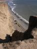
 Our Punta Camalu campsite from above
Links to related images: Nearby. Proofs. Map.
Approximate location: 30.82195N / 116.08641W.
 Punta Camalu has a hotel/bar/restaurant that we eat and drink at
Links to related images: Nearby. Proofs. Map.
Approximate location: 30.82195N / 116.08641W.
 Gregg Berman back in our Punta Camalu campsite
Links to related images: Nearby. Proofs. Map.
Approximate location: 30.82199N / 116.08646W.
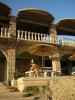
 The swimming pool at the Punta Camalu Hotel
Links to related images: Nearby. Proofs. Map.
Approximate location: 30.8221N / 116.08903W.
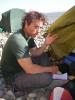
 Charles Harris chilling at the Punta Camalu Hotel
Links to related images: Nearby. Proofs. Map.
Approximate location: 30.8221N / 116.08903W.
 Gregg Berman and his new friend at the Punta Camalu Restaurant
Links to related images: Nearby. Proofs. Map.
Approximate location: 30.82234N / 116.08882W.
All text and images Copyright © 2007 by Mike Higgins / contact