Arroyo de la Viper to Loreto, April 10th 2007.
Click on the small image to see the full-sized one.
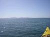
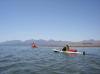
 Doug Hamilton paddling away from camp in the morning
Links to related images: Nearby. Proofs. Map.
Approximate location: 26.12313N / 111.34807W.
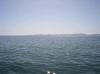
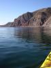 Calm water near camp in the morning
Links to related images: Nearby. Proofs. Map.
Approximate location: 26.12171N / 111.3477W.
 Doug Hamilton paddling away from camp in the morning
Links to related images: Nearby. Proofs. Map.
Approximate location: 26.12171N / 111.3477W.


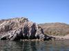
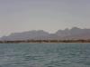
 The cliffs give way to low bluffs near Loreto
Links to related images: Nearby. Proofs. Map.
Approximate location: 26.10995N / 111.34133W.
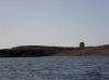
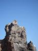 Another osprey on a nest on a rock
Links to related images: Nearby. Proofs. Map.
Approximate location: 26.10982N / 111.34148W.
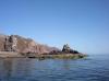
 Last rocky reef before Loreto
Links to related images: Nearby. Proofs. Map.
Approximate location: 26.10738N / 111.33742W.
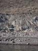
 A chain link fence around a dirt airstrip
Links to related images: Nearby. Proofs. Map.
Approximate location: 26.10512N / 111.33536W.

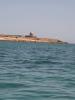
 A hotel abandond partway through construction
Links to related images: Nearby. Proofs. Map.
Approximate location: 26.10062N / 111.32427W.
 Doug Hamilton approaching the outsirts of Loreto
Links to related images: Nearby. Proofs. Map.
Approximate location: 26.09832N / 111.32369W.
 A hotel abandond partway through construction
Links to related images: Nearby. Proofs. Map.
Approximate location: 26.09487N / 111.3236W.
 Doug Hamilton approaching the outsirts of Loreto
Links to related images: Nearby. Proofs. Map.
Approximate location: 26.07399N / 111.31809W.
 Isla Carmen, I may have to go there one day
Links to related images: Nearby. Proofs. Map.
Approximate location: 26.07373N / 111.31805W.
 The 'natives' are friendly in the outskirts of Loreto
Links to related images: Nearby. Proofs. Map.
Approximate location: 26.06882N / 111.31903W.
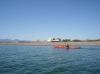
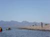
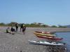 We stop for a break in the outskirts of Loreto
Links to related images: Nearby. Proofs. Map.
Approximate location: 26.06575N / 111.32127W.
 Doug Hamilton and Kate DesLouriers starting the last stretch to Loreto
Links to related images: Nearby. Proofs. Map.
Approximate location: 26.04981N / 111.32785W.
 Approaching Loreto and the end of our trip
Links to related images: Nearby. Proofs. Map.
Approximate location: 26.02708N / 111.33897W.
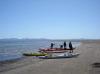
 Landing in front of a hotel in Loreto
Links to related images: Nearby. Proofs. Map.
Approximate location: 26.00689N / 111.33858W.
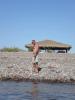
 The hotel opens the kitchen to serve us lunch
Links to related images: Nearby. Proofs. Map.
Approximate location: 26.00678N / 111.33873W.
 Don Sailing in front of Isla Carmen
Links to related images: Nearby. Proofs. Map.
Approximate location: 26.00678N / 111.33873W.
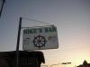 Mike's Bar in Loreto
Links to related images: Nearby. Proofs. Map.
Approximate location: 26.00678N / 111.33873W.
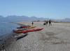
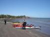
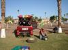 The intrepid kayaker packing up the truck in Loreto
Links to related images: Nearby. Proofs. Map.
Approximate location: 25.99943N / 111.3387W.
All text and images Copyright © 2007 by Mike Higgins / contact