Layover Day near Punta Mendenares, April 7th 2007.
Click on the small image to see the full-sized one.
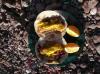 Breakfast tacos with eggs donated by 'The Girls'
Links to related images: Nearby. Proofs. Map.
Approximate location: 26.32125N / 111.38751W.
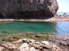
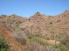
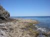 Looking back at Punta el Pulpito from our camping beach
Links to related images: Nearby. Proofs. Map.
Approximate location: 26.32125N / 111.38751W.
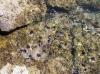
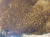

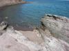
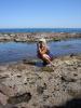
 Tide pooling around camp on a layover day
Links to related images: Nearby. Proofs. Map.
Approximate location: 26.32125N / 111.38751W.
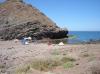 Our camp on a layover day
Links to related images: Nearby. Proofs. Map.
Approximate location: 26.32125N / 111.38751W.
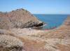
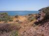
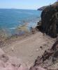 Looking down at the next beach north
Links to related images: Nearby. Proofs. Map.
Approximate location: 26.32084N / 111.38757W.
 Our camp on a layover day
Links to related images: Nearby. Proofs. Map.
Approximate location: 26.32084N / 111.38757W.
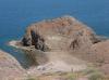
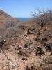
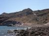
 Isla Coronados viewd over the next large beach north
Links to related images: Nearby. Proofs. Map.
Approximate location: 26.32037N / 111.38862W.

 Our camp on a layover day
Links to related images: Nearby. Proofs. Map.
Approximate location: 26.32159N / 111.38918W.
 Isla Coronados viewd over the next large beach north
Links to related images: Nearby. Proofs. Map.
Approximate location: 26.32159N / 111.38918W.
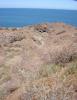

 The arroyo behind our camp
Links to related images: Nearby. Proofs. Map.
Approximate location: 26.32088N / 111.39014W.
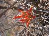 Ocatia flower in the arroyo behind our camp
Links to related images: Nearby. Proofs. Map.
Approximate location: 26.32065N / 111.3898W.
 The arroyo behind our camp
Links to related images: Nearby. Proofs. Map.
Approximate location: 26.32065N / 111.3898W.
 Isla Coronado viewd from the arroyo behind our camp
Links to related images: Nearby. Proofs. Map.
Approximate location: 26.31884N / 111.38834W.
 The arroyo behind our camp
Links to related images: Nearby. Proofs. Map.
Approximate location: 26.31884N / 111.38834W.
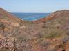
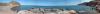 Pamorama of the next large beach north from camp
Links to related images: Nearby. Proofs. Map.
Approximate location: 26.31771N / 111.38802W.

 The next large beach north from camp
Links to related images: Nearby. Proofs. Map.
Approximate location: 26.31874N / 111.38742W.
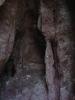
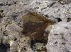
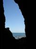 A dry cave full of bats
Links to related images: Nearby. Proofs. Map.
Approximate location: 26.31919N / 111.38716W.

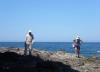

 Herbe Howe and Andrea Wolf tide pooling
Links to related images: Nearby. Proofs. Map.
Approximate location: 26.32116N / 111.38654W.
All text and images Copyright © 2007 by Mike Higgins / contact