Punta Pilares to Punta Santa Rosa, April 2nd 2007.
Click on the small image to see the full-sized one.
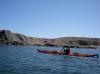
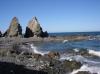
 Herb Howe leaving Punta Pilares
Links to related images: Nearby. Proofs. Map.
Approximate location: 26.88606N / 111.80069W.
 Andrea Wolf leaving Punta Pilares
Links to related images: Nearby. Proofs. Map.
Approximate location: 26.88606N / 111.80069W.
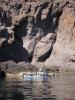
 The foundations of the ore processing buildings viewed from the water
Links to related images: Nearby. Proofs. Map.
Approximate location: 26.87436N / 111.78795W.
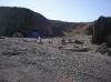
 The aroyo with a road back to civilazation from the mining town
Links to related images: Nearby. Proofs. Map.
Approximate location: 26.87436N / 111.78795W.
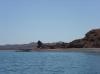
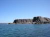
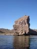 Another rock with an osprey nest
Links to related images: Nearby. Proofs. Map.
Approximate location: 26.87436N / 111.78795W.
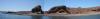
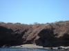
 Beaches with arroyos, we could camp on any of these
Links to related images: Nearby. Proofs. Map.
Approximate location: 26.87387N / 111.78748W.
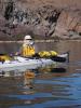
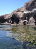
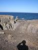
 Kate DesLauriers watching me enter a cave
Links to related images: Nearby. Proofs. Map.
Approximate location: 26.86681N / 111.77535W.
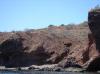
 A smaller group could camp in these caves
Links to related images: Nearby. Proofs. Map.
Approximate location: 26.8493N / 111.75291W.
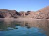
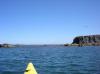
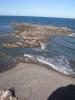
 Beautiful reef just under the surface near a point
Links to related images: Nearby. Proofs. Map.
Approximate location: 26.84327N / 111.74583W.
 Doug Hamilton paddling south from Punta Pilares
Links to related images: Nearby. Proofs. Map.
Approximate location: 26.83962N / 111.74177W.
 Everyone landed for a break
Links to related images: Nearby. Proofs. Map.
Approximate location: 26.83561N / 111.74074W.
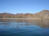
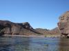
 Rounding several low points
Links to related images: Nearby. Proofs. Map.
Approximate location: 26.82121N / 111.72761W.
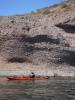
 Doug Hamilton rock gardening close to shore, as usual
Links to related images: Nearby. Proofs. Map.
Approximate location: 26.8196N / 111.72637W.
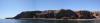
 Red bluffy shore north of Punta Santa Rosa
Links to related images: Nearby. Proofs. Map.
Approximate location: 26.8196N / 111.72637W.
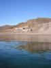
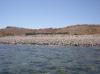 Foundation of a house or a corral north of Punta Santa Rosa
Links to related images: Nearby. Proofs. Map.
Approximate location: 26.79726N / 111.70381W.
 Landed for a lunch break north of Punta Santa Rosa
Links to related images: Nearby. Proofs. Map.
Approximate location: 26.79271N / 111.69868W.
 Doug Hamilton paddling south to Punta Santa Rosa
Links to related images: Nearby. Proofs. Map.
Approximate location: 26.78096N / 111.66688W.
 The tip of Punta Santa Rosa
Links to related images: Nearby. Proofs. Map.
Approximate location: 26.78096N / 111.66688W.

 Setting up camp on Punta Santa Rosa
Links to related images: Nearby. Proofs. Map.
Approximate location: 26.77902N / 111.66738W.

 Our camp on Punta Santa Rosa viewed from above
Links to related images: Nearby. Proofs. Map.
Approximate location: 26.77941N / 111.66701W.
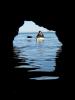
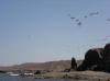
 Pelicans off Punta Santa Rosa
Links to related images: Nearby. Proofs. Map.
Approximate location: 26.77941N / 111.66701W.
 Reefs off Punta Santa Rosa
Links to related images: Nearby. Proofs. Map.
Approximate location: 26.77941N / 111.66701W.
 Dolphin backbone at Punta Santa Rosa
Links to related images: Nearby. Proofs. Map.
Approximate location: 26.77941N / 111.66701W.

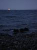 The full moon rises at our camp at Punta Santa Rosa
Links to related images: Nearby. Proofs. Map.
Approximate location: 26.7784N / 111.66654W.
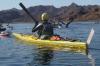 The intrepid kayaker paddling to Punta Santa Rosa
Links to related images: Nearby. Proofs. Map.
Approximate location: 26.8114N / 111.72016W.
 The intrepid kayaker rock gardening near Punta Santa Rosa
Links to related images: Nearby. Proofs. Map.
Approximate location: 26.78052N / 111.66751W.
All text and images Copyright © 2007 by Mike Higgins / contact