Mulege to Punta Pilares, March 31st 2007.
Click on the small image to see the full-sized one.
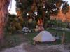
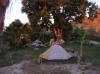 Our campsite in Mulege
Links to related images: Nearby. Proofs. Map.
Approximate location: 26.88627N / 111.92779W.
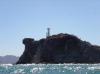
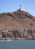 The Mulege Faro
Links to related images: Nearby. Proofs. Map.
Approximate location: 26.88627N / 111.92779W.
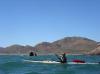 Kate DesLauriers leaving Mulege behind
Links to related images: Nearby. Proofs. Map.
Approximate location: 26.88627N / 111.92779W.
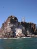

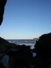
 Stopping for a rest at Isla El Gallo
Links to related images: Nearby. Proofs. Map.
Approximate location: 26.87758N / 111.91253W.
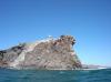
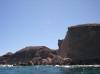
 Approaching land at Punta Los Hornitos on Punta Concepcion
Links to related images: Nearby. Proofs. Map.
Approximate location: 26.88176N / 111.85859W.

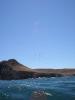
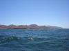
 Birds over Punta Concepcion
Links to related images: Nearby. Proofs. Map.
Approximate location: 26.89099N / 111.80906W.
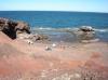
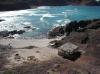
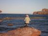
 Safely landed behind Punta Pilares
Links to related images: Nearby. Proofs. Map.
Approximate location: 26.88672N / 111.80153W.
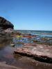
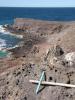
 Our camp behind Punta Pilares viewed from above
Links to related images: Nearby. Proofs. Map.
Approximate location: 26.88648N / 111.80147W.
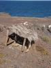
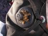
 A small palapa shrine on Punta Pilares
Links to related images: Nearby. Proofs. Map.
Approximate location: 26.88732N / 111.80245W.

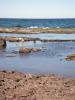
 Rough waves breaking on the north side of Punta Pilares
Links to related images: Nearby. Proofs. Map.
Approximate location: 26.88771N / 111.80166W.
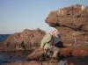
 Herb Howe soaking in warm water behind the reef at Punta Pilares
Links to related images: Nearby. Proofs. Map.
Approximate location: 26.88771N / 111.80166W.
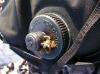 Honey bees loved Kate DesLauriers leaky watter bottle caps
Links to related images: Nearby. Proofs. Map.
Approximate location: 26.88771N / 111.80166W.
 Honey bees loved Kate DesLaurier's leaky watter bottle caps
Links to related images: Nearby. Proofs. Map.
Approximate location: 26.88771N / 111.80166W.
 A view south from our 'kitchen' at Punta Pilares
Links to related images: Nearby. Proofs. Map.
Approximate location: 26.88771N / 111.80166W.
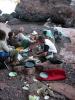 Doug Hamilton cooking dinner at Punta Pilares
Links to related images: Nearby. Proofs. Map.
Approximate location: 26.88771N / 111.80166W.
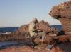 The intrepid kayaker pumping the desalinator at Punta Pilares
Links to related images: Nearby. Proofs. Map.
Approximate location: 26.88649N / 111.80147W.
All text and images Copyright © 2007 by Mike Higgins / contact