Fort Canby State Park to Ilwaco Marina, August 16th 2006.
Click on the small image to see the full-sized one.
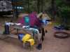 Our campsite at Fort Canby State Park
Links to related images: Nearby. Proofs. Map.
Approximate location: 46.293342590332N / 124.07332611084W.
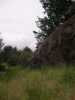
 The kayaks hidden in the saw grass all night at Fort Canby State Park
Links to related images: Nearby. Proofs. Map.
Approximate location: 46.2927474975586N / 124.075729370117W.
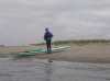
 Roger rock climbing at Fort Canby State Park
Links to related images: Nearby. Proofs. Map.
Approximate location: 46.2930450439453N / 124.072547912598W.
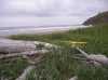
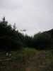
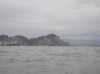
 The surf looks OK in the morning at Fort Canby State Park
Links to related images: Nearby. Proofs. Map.
Approximate location: 46.2947044372559N / 124.076156616211W.

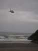


 The Coast Guard Helicopter looking for someone else at Fort Canby State Park
Links to related images: Nearby. Proofs. Map.
Approximate location: 46.2959518432617N / 124.074867248535W.

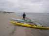
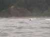 Roger making it out through the surf at Fort Canby State Park
Links to related images: Nearby. Proofs. Map.
Approximate location: 46.2939949035645N / 124.07950592041W.
 The North Head Lighthouse from the water at Fort Canby State Park
Links to related images: Nearby. Proofs. Map.
Approximate location: 46.2937545776367N / 124.079849243164W.
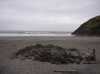
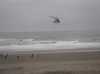
 Looking back at the beach at Fort Canby State Park
Links to related images: Nearby. Proofs. Map.
Approximate location: 46.2903175354004N / 124.081047058105W.
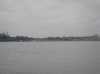
 Traffic going behind the jetty into the Columbia River
Links to related images: Nearby. Proofs. Map.
Approximate location: 46.2713928222656N / 124.086280822754W.
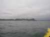
 The end of the jetty entering the Columbia River
Links to related images: Nearby. Proofs. Map.
Approximate location: 46.2628479003906N / 124.087997436523W.
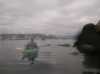
 The last picture the camera got before the wave hit while entering the Columbia River
Links to related images: Nearby.
Approximate location: 46.2626724243164N / 124.086799621582W.
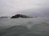
 Cape Dissapointment from inside the Columbia River
Links to related images: Nearby. Proofs. Map.
Approximate location: 46.2653999328613N / 124.06388092041W.
 Roger in the channel to the town of Ilwaco
Links to related images: Nearby. Proofs. Map.
Approximate location: 46.267894744873N / 124.036331176758W.
 My boat on Sand Island in the state of Oregon!
Links to related images: Nearby. Proofs. Map.
Approximate location: 46.2796974182129N / 124.035385131836W.
 A couple of kayakers I met on Sand Island
Links to related images: Nearby. Proofs. Map.
Approximate location: 46.2796974182129N / 124.035385131836W.
 The intrepid kayaker after paddling all of Washington, on Sand Island in Oregon
Links to related images: Nearby. Proofs. Map.
Approximate location: 46.2796974182129N / 124.035385131836W.
 Roger Lamb after paddling all of Washington, on Sand Island in Oregon
Links to related images: Nearby. Proofs. Map.
Approximate location: 46.2811813354492N / 124.036590576172W.
 Approaching the town of Ilwaco
Links to related images: Nearby. Proofs. Map.
Approximate location: 46.2888946533203N / 124.039421081543W.
 Roger Lamb rounding the breakwater into the Ilwaco marina
Links to related images: Nearby. Proofs. Map.
Approximate location: 46.3024139404297N / 124.041397094727W.
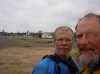 Roger Lamb and I after paddling all of Washington State
Links to related images: Nearby. Proofs. Map.
Approximate location: 46.3027687072754N / 124.036674499512W.
All text and images Copyright © 2006 by Mike Higgins / contact