Cape Flattery to Ozette Island August 8th 2006.
Click on the small image to see the full-sized one.
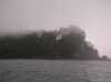
 Large cave in Cape Flattery
Links to related images: Nearby. Proofs. Map.
Approximate location: 48.3866386413574N / 124.722717285156W.

 Roger Lamb waiting for the tide on Cape Flattery
Links to related images: Nearby. Proofs. Map.
Approximate location: 48.3852157592773N / 124.724433898926W.
 Roger Lamb in front of Tatoosh Island
Links to related images: Nearby. Proofs. Map.
Approximate location: 48.3862953186035N / 124.729415893555W.


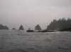
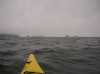
 Sea Stacks off Cape Flattery
Links to related images: Nearby. Proofs. Map.
Approximate location: 48.380199432373N / 124.733619689941W.
 Roger Lamb paddling south from Cape Flattery
Links to related images: Nearby. Proofs. Map.
Approximate location: 48.3522567749023N / 124.712074279785W.
 Grey whale near Hobuck Beach
Links to related images: Nearby. Proofs. Map.
Approximate location: 48.3335456848145N / 124.692337036133W.
 Mist over Hobuck Beach
Links to related images: Nearby. Proofs. Map.
Approximate location: 48.3179092407227N / 124.682289123535W.


 Approaching Anderson Point
Links to related images: Nearby. Proofs. Map.
Approximate location: 48.2997550964355N / 124.681091308594W.


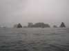
 Arches in Point of the Arches
Links to related images: Nearby. Proofs. Map.
Approximate location: 48.2486839294434N / 124.703575134277W.
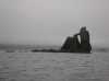
 Father and Son rocks
Links to related images: Nearby. Proofs. Map.
Approximate location: 48.2434234619141N / 124.713104248047W.
 Rock full of caves we had no time to explore
Links to related images: Nearby. Proofs. Map.
Approximate location: 48.2277603149414N / 124.707527160645W.
 Looking back at Point of Arches
Links to related images: Nearby. Proofs. Map.
Approximate location: 48.225528717041N / 124.705810546875W.
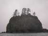
 Offshore rocks with trees on top
Links to related images: Nearby. Proofs. Map.
Approximate location: 48.1826286315918N / 124.714393615723W.
 Approaching Ozette Island
Links to related images: Nearby. Proofs. Map.
Approximate location: 48.1725540161133N / 124.737564086914W.
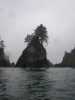
 The north end of Ozette Island
Links to related images: Nearby. Proofs. Map.
Approximate location: 48.1622505187988N / 124.754302978516W.
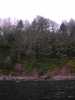 The rocky NE shore of Ozette Island
Links to related images: Nearby. Proofs. Map.
Approximate location: 48.1600151062012N / 124.750274658203W.
 Rock offshore from Ozette Island
Links to related images: Nearby. Proofs. Map.
Approximate location: 48.1585006713867N / 124.749000549316W.
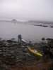 Landing on Ozette Island for the evening
Links to related images: Nearby. Proofs. Map.
Approximate location: 48.1585006713867N / 124.749000549316W.
All text and images Copyright © 2006 by Mike Higgins / contact