Fort Ross Cultural History Day, July 29th 2006.
Click on the small image to see the full-sized one.
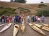
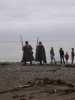
 The procession arrives to bless the kayak fleet
Links to related images: Nearby. Proofs. Map.
Approximate location: 38.5120506286621N / 123.243141174316W.
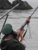
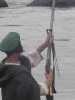 Muskets are fired to honor the kayak fleet
Links to related images: Nearby. Proofs. Map.
Approximate location: 38.5120506286621N / 123.243141174316W.
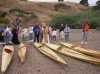
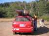 Marcus Koenen loads his baidarkas up at the end of the day
Links to related images: Nearby. Proofs. Map.
Approximate location: 38.5120506286621N / 123.243141174316W.
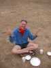
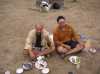 Steve Kaspar and Wolfgang Brinck enjoy dinner
Links to related images: Nearby. Proofs. Map.
Approximate location: 38.5120506286621N / 123.243141174316W.
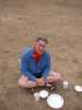
 Dave Littlejohn enjoys dinner at Fort Ross Living History Day
Links to related images: Nearby. Proofs. Map.
Approximate location: 38.5120506286621N / 123.243141174316W.
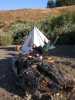
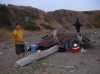 Wolfgang Brinck and his Alutian camp on the beach at Fort Ross
Links to related images: Nearby. Proofs. Map.
Approximate location: 38.5120506286621N / 123.243141174316W.
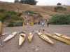
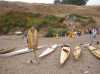
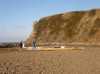
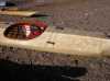
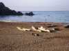 Baidarkas on the beach at Fort Ross Living History Day
Links to related images: Nearby. Proofs. Map.
Approximate location: 38.5120506286621N / 123.243141174316W.
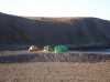 Tents on the beach after Fort Ross Living History Day
Links to related images: Nearby. Proofs. Map.
Approximate location: 38.5120506286621N / 123.243141174316W.
 Steve Kaspar and his primitive tent on the beach after Fort Ross Living History Day
Links to related images: Nearby. Proofs. Map.
Approximate location: 38.5120506286621N / 123.243141174316W.
 Dörte and Dave Littlejohn on the beach after Fort Ross Living History Day
Links to related images: Nearby. Proofs. Map.
Approximate location: 38.5120506286621N / 123.243141174316W.
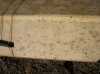 Simulated seal skin on Wolfgang Brinck's kayak at Fort Ross Living History Day
Links to related images: Nearby. Proofs. Map.
Approximate location: 38.5120506286621N / 123.243141174316W.
All text and images Copyright © 2006 by Mike Higgins / contact