Honeymoon Cove to West Isla Tiburonm October 26th 2004.
Click on the small image to see the full-sized one.
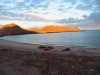
 Morning light at Honeymoon Cove on Isla Tiburon
Links to related images: Nearby. Proofs. Map.
Approximate location: 28.8880443572998N / 112.560249328613W.
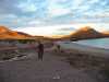
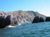
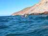
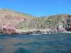
 Heading north across Bahia Vaporeta on Isla Tiburon
Links to related images: Nearby. Proofs. Map.
Approximate location: 28.9384574890137N / 112.514587402344W.
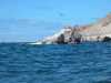
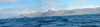
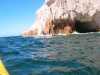
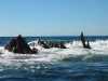
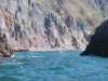
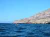
 Rocks north of Bahia Vaporetta on Isla Tiburon
Links to related images: Nearby. Proofs. Map.
Approximate location: 28.9898223876953N / 112.496910095215W.
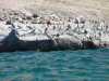
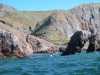
 John Somers north of Bahia Vaporetta on Isla Tiburon
Links to related images: Nearby. Proofs. Map.
Approximate location: 28.9914741516113N / 112.49828338623W.
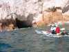
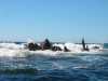
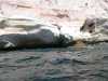
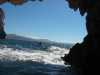 Inside cave north of Bahia Vaporetta on Isla Tiburon
Links to related images: Nearby. Proofs. Map.
Approximate location: 28.9956798553467N / 112.500175476074W.
 Lucy O'Brien and cave north of Bahia Vaporetta on Isla Tiburon
Links to related images: Nearby. Proofs. Map.
Approximate location: 28.9956798553467N / 112.500175476074W.
 John Somers and cave north of Bahia Vaporetta on Isla Tiburon
Links to related images: Nearby. Proofs. Map.
Approximate location: 28.9956798553467N / 112.500175476074W.
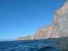
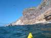
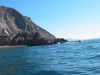
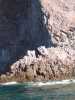
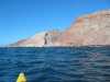
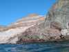
 White cliffs on west side of Isla Tiburon
Links to related images: Nearby. Proofs. Map.
Approximate location: 29.0033359527588N / 112.500854492188W.
 Carved rock formation on west side of Isla Tiburon
Links to related images: Nearby. Proofs. Map.
Approximate location: 29.0049877166748N / 112.502059936523W.
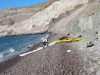
 Possible landing spot on west side of Isla Tiburon
Links to related images: Nearby. Proofs. Map.
Approximate location: 29.0142955780029N / 112.505836486816W.
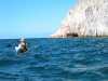
 John and Lucy in play spot on west side of Isla Tiburon
Links to related images: Nearby. Proofs. Map.
Approximate location: 29.021800994873N / 112.502059936523W.
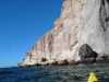
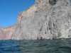
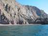
 Steep rocky shoreline of the west side of Isla Tiburon
Links to related images: Nearby. Proofs. Map.
Approximate location: 29.0455150604248N / 112.502922058105W.
 Poor but possible landing spot on the west side of Isla Tiburon
Links to related images: Nearby. Proofs. Map.
Approximate location: 29.0504665374756N / 112.500854492188W.
 Steep rocky shoreline of the west side of Isla Tiburon
Links to related images: Nearby. Proofs. Map.
Approximate location: 29.0531692504883N / 112.500511169434W.
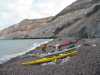 Our campsite on the west side of Isla Tiburon
Links to related images: Nearby. Proofs. Map.
Approximate location: 29.0558700561523N / 112.500686645508W.
All text and images Copyright © 2004 by Mike Higgins / contact