Naples to the Santa Barbara Harbor, September 7th 2004.
Click on the small image to see the full-sized one.
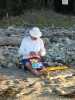 Fred Cooper taping his blisters at Naples
Links to related images: Nearby. Proofs. Map.
Approximate location: 34.4351997375488N / 119.929000854492W.
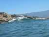
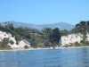
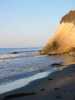 Morning sunlight on the waves
at Naples
Morning sunlight on the waves
at Naples
Links to related images: Nearby. Proofs. Map.
Approximate location: 34.4351997375488N / 119.928848266602W.
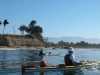
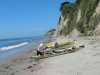
 Fred and John launching
at Naples
Fred and John launching
at Naples
Links to related images: Nearby. Proofs. Map.
Approximate location: 34.4351997375488N / 119.928848266602W.
 John Somers and Fred Cooper at Coal Oil Point
Links to related images: Nearby. Proofs. Map.
Approximate location: 34.4062004089355N / 119.878997802734W.
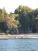
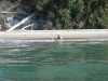
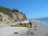
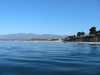 The beach
at Coal Oil Point
The beach
at Coal Oil Point
Links to related images: Nearby. Proofs. Map.
Approximate location: 34.4061889648438N / 119.879371643066W.
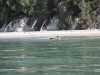
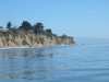
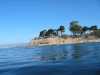 The tip of the point
at Coal Oil Point
The tip of the point
at Coal Oil Point
Links to related images: Nearby. Proofs. Map.
Approximate location: 34.4058456420898N / 119.876121520996W.
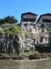
 Houses on the edge of the cliff
at Goletta Point
Houses on the edge of the cliff
at Goletta Point
Links to related images: Nearby. Proofs. Map.
Approximate location: 34.409008026123N / 119.860237121582W.
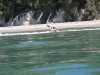
 Wave at the tip of the point
at Goletta Point
Wave at the tip of the point
at Goletta Point
Links to related images: Nearby. Proofs. Map.
Approximate location: 34.4037017822266N / 119.844062805176W.
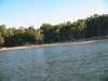
 Kayaks at a stop for a break
at Goletta Beach
Kayaks at a stop for a break
at Goletta Beach
Links to related images: Nearby. Proofs. Map.
Approximate location: 34.4162483215332N / 119.811508178711W.
 Fred launching
at Goletta Beach
Fred launching
at Goletta Beach
Links to related images: Nearby. Proofs. Map.
Approximate location: 34.4162483215332N / 119.811508178711W.
 John launching
at Goletta Beach
John launching
at Goletta Beach
Links to related images: Nearby. Proofs. Map.
Approximate location: 34.4162483215332N / 119.811508178711W.
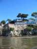
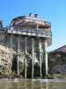
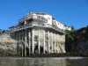
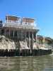
 Private beach house
at Santa Barbara Point
Private beach house
at Santa Barbara Point
Links to related images: Nearby. Proofs. Map.
Approximate location: 34.4010314941406N / 119.743850708008W.
 The last point of the trip
at Santa Barbara Point
The last point of the trip
at Santa Barbara Point
Links to related images: Nearby. Proofs. Map.
Approximate location: 34.3972969055176N / 119.70320892334W.
 John and Fred on lunch break
at Santa Barbara Point
John and Fred on lunch break
at Santa Barbara Point
Links to related images: Nearby. Proofs. Map.
Approximate location: 34.3979148864746N / 119.702850341797W.
 Birds
at Santa Barbara Point
Birds
at Santa Barbara Point
Links to related images: Nearby. Proofs. Map.
Approximate location: 34.3979148864746N / 119.702850341797W.
 Fred and John packing up after lunch
at Santa Barbara Point
Fred and John packing up after lunch
at Santa Barbara Point
Links to related images: Nearby. Proofs. Map.
Approximate location: 34.3979148864746N / 119.702850341797W.
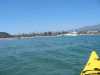 "Swim zone at Santa Barbara Harbor
Links to related images: Nearby. Proofs. Map.
Approximate location: 34.3999900817871N / 119.697059631348W.

 The kayaks landed on the boatramp
at Santa Barbara Harbor
The kayaks landed on the boatramp
at Santa Barbara Harbor
Links to related images: Nearby. Proofs. Map.
Approximate location: 34.4084663391113N / 119.692451477051W.
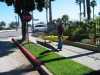 The intrepid kayaker rolling his kayak to a motel
at Santa Barbara Harbor
The intrepid kayaker rolling his kayak to a motel
at Santa Barbara Harbor
Links to related images: Nearby. Proofs. Map.
Approximate location: 34.4092636108398N / 119.693481445312W.
All text and images Copyright © 2004 by Mike Higgins / contact