Pelican Beach to Naples, September 6th 2004.
Click on the small image to see the full-sized one.
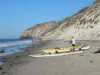
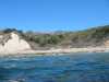
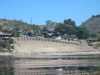
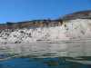 Our next campground
at Pelican Beach
Our next campground
at Pelican Beach
Links to related images: Nearby. Proofs. Map.
Approximate location: 34.467716217041N / 120.240982055664W.
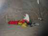 Fred Cooper waking up at Pelican Beach
Links to related images: Nearby. Proofs. Map.
Approximate location: 34.4684944152832N / 120.241241455078W.
 John Somers waking up at Pelican Beach
Links to related images: Nearby. Proofs. Map.
Approximate location: 34.4684944152832N / 120.241241455078W.
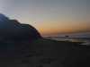 Sunrise
at Pelican Beach
Sunrise
at Pelican Beach
Links to related images: Nearby. Proofs. Map.
Approximate location: 34.4684944152832N / 120.241241455078W.
 John Somers packing at Pelican Beach
Links to related images: Nearby. Proofs. Map.
Approximate location: 34.4684944152832N / 120.241241455078W.
 John and Fred still packing
at Pelican Beach
John and Fred still packing
at Pelican Beach
Links to related images: Nearby. Proofs. Map.
Approximate location: 34.4677886962891N / 120.240982055664W.
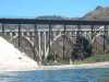
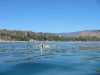
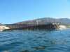 The pier
at Gaviota Beach
The pier
at Gaviota Beach
Links to related images: Nearby. Proofs. Map.
Approximate location: 34.468635559082N / 120.229995727539W.
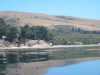
 Ninja camping possibility
at Gaviota Beach
Ninja camping possibility
at Gaviota Beach
Links to related images: Nearby. Proofs. Map.
Approximate location: 34.4694137573242N / 120.219696044922W.
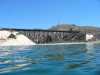
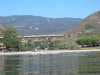
 Railroad and highway crossing
at Gaviota Beach
Railroad and highway crossing
at Gaviota Beach
Links to related images: Nearby. Proofs. Map.
Approximate location: 34.468921661377N / 120.205360412598W.
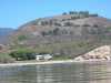
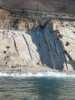
 Creative architecture
at Capitan
Creative architecture
at Capitan
Links to related images: Nearby. Proofs. Map.
Approximate location: 34.4630317687988N / 120.041061401367W.
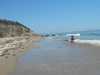
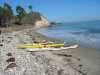
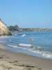
 Fred Cooper in front of beach at El Capitan Beach
Links to related images: Nearby. Proofs. Map.
Approximate location: 34.4592971801758N / 120.071380615234W.
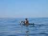 John Somers near El Capitan Beach
Links to related images: Nearby. Proofs. Map.
Approximate location: 34.4592971801758N / 120.071380615234W.
 Looking east past John
at El Capitan Beach
Looking east past John
at El Capitan Beach
Links to related images: Nearby. Proofs. Map.
Approximate location: 34.4592971801758N / 120.071380615234W.
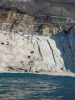
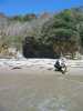
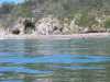
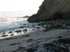
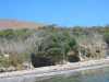 Caves above sand
at El Capitan Beach
Caves above sand
at El Capitan Beach
Links to related images: Nearby. Proofs. Map.
Approximate location: 34.4609298706055N / 120.011573791504W.
 Fred Cooper landed for lunch at El Capitan Beach
Links to related images: Nearby. Proofs. Map.
Approximate location: 34.4608993530273N / 120.012001037598W.
 Kids on the beach
at El Capitan Beach
Kids on the beach
at El Capitan Beach
Links to related images: Nearby. Proofs. Map.
Approximate location: 34.4609298706055N / 120.011573791504W.
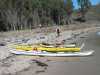
 Fred and John packing up after lunch
at El Capitan Beach
Fred and John packing up after lunch
at El Capitan Beach
Links to related images: Nearby. Proofs. Map.
Approximate location: 34.4609298706055N / 120.011573791504W.
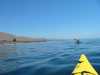
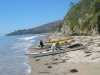
 Fred and John launching after lunch
at El Capitan Beach
Fred and John launching after lunch
at El Capitan Beach
Links to related images: Nearby. Proofs. Map.
Approximate location: 34.4609298706055N / 120.011573791504W.
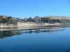
 Landed at our campground for the night
at Naples
Landed at our campground for the night
at Naples
Links to related images: Nearby. Proofs. Map.
Approximate location: 34.4351997375488N / 119.928848266602W.
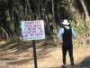 Fred Cooper ignores the warning sign at Naples
Links to related images: Nearby. Proofs. Map.
Approximate location: 34.4351997375488N / 119.929000854492W.
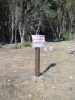 The keep out signs
at Naples
The keep out signs
at Naples
Links to related images: Nearby. Proofs. Map.
Approximate location: 34.4351997375488N / 119.928848266602W.
 Fred Cooper takes a bath at Naples
Links to related images: Nearby. Proofs. Map.
Approximate location: 34.4351997375488N / 119.929000854492W.
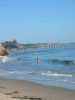
 Evening sunlight on the waves
at Naples
Evening sunlight on the waves
at Naples
Links to related images: Nearby. Proofs. Map.
Approximate location: 34.4351997375488N / 119.928848266602W.
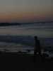 John Somers after dark in front of pier at Naples
Links to related images: Nearby. Proofs. Map.
Approximate location: 34.4351997375488N / 119.929000854492W.
All text and images Copyright © 2004 by Mike Higgins / contact