Mike's Kayak Journal, all photos taken on 2004-07-25
Click on the small image to see the full-sized one.
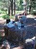 Buck Island Lake campground with 'tables'.
Links to related images: Nearby. Proofs. Map.
Approximate location: 39.0018615722656N / 120.254341125488W.
 Tent and kayak at Buck Island Lake campground.
Links to related images: Nearby. Proofs. Map.
Approximate location: 39.0018615722656N / 120.254341125488W.

 Stream feading Rockbound Lake in the Desolation Wilderness.
Links to related images: Nearby. Proofs. Map.
Approximate location: 38.9889183044434N / 120.233711242676W.

 Lost in the Desolation Wilderness near Rubicon Resevoir.
Links to related images: Nearby. Proofs. Map.
Approximate location: 38.9889183044434N / 120.233711242676W.
 Looking down at Rockbound Lake.
Links to related images: Nearby. Proofs. Map.
Approximate location: 38.9877014160156N / 120.228149414062W.

 Finally found the Rubicon Resevoir again.
Links to related images: Nearby. Proofs. Map.
Approximate location: 38.9877014160156N / 120.228149414062W.


 The Rubicon Resevoir end of the tunnel to Rockbound Lake
Links to related images: Nearby. Proofs. Map.
Approximate location: 38.9877014160156N / 120.225997924805W.


 The Rubicon Resevoir end of the tunnel to Rockbound Lake.
Links to related images: Nearby. Proofs. Map.
Approximate location: 38.9877014160156N / 120.225997924805W.


 The Rockbound Lake end of the tunnel to Rubicon Resevoir.
Links to related images: Nearby. Proofs. Map.
Approximate location: 38.9901885986328N / 120.230781555176W.
 A panorama of Rockbound Lake.
Links to related images: Nearby. Proofs. Map.
Approximate location: 38.9952201843262N / 120.239402770996W.
All text and images Copyright © 2004 by Mike Higgins / contact