Punta el Pulpito to Punta Rocosa, April 20th 2003.
Click on the small image to see the full-sized one.
 Signs of human activity
Links to related images: Nearby. Proofs. Map.
Approximate location: 29.3792591094971N / 113.35684967041W.
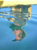
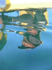 Patrick's reflection in calm water
Links to related images: Nearby. Proofs. Map.
Approximate location: 29.3552474975586N / 113.35865020752W.
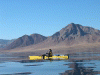
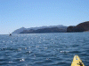
 Pulpito Bay
Links to related images: Nearby. Proofs. Map.
Approximate location: 29.3289108276367N / 113.351440429688W.
 Point Pulpito behind us
Links to related images: Nearby. Proofs. Map.
Approximate location: 29.3289108276367N / 113.351440429688W.
 Patrick in Pulpito Bay
Links to related images: Nearby. Proofs. Map.
Approximate location: 29.3289108276367N / 113.351440429688W.
 Punta Roca ahead of us
Links to related images: Nearby. Proofs. Map.
Approximate location: 29.3190326690674N / 113.290328979492W.
 Patrick landed at lagoon
Links to related images: Nearby. Proofs. Map.
Approximate location: 29.2826557159424N / 113.287582397461W.
 Pulpito behind lagoon entrance
Links to related images: Nearby. Proofs. Map.
Approximate location: 29.2826557159424N / 113.287582397461W.
 lagoon entrance
Links to related images: Nearby. Proofs. Map.
Approximate location: 29.2826557159424N / 113.287582397461W.
 lagoon
Links to related images: Nearby. Proofs. Map.
Approximate location: 29.2826557159424N / 113.287582397461W.
 dead sea turtle at lagoon
Links to related images: Nearby. Proofs. Map.
Approximate location: 29.2826557159424N / 113.287582397461W.
 dead dolphin at lagoon
Links to related images: Nearby. Proofs. Map.
Approximate location: 29.2826557159424N / 113.287582397461W.
 rocky point
Links to related images: Nearby. Proofs. Map.
Approximate location: 29.2889442443848N / 113.282264709473W.
 spire of rock with osprey nest
Links to related images: Nearby. Proofs. Map.
Approximate location: 29.2889442443848N / 113.282264709473W.
 osprey landing on nest
Links to related images: Nearby. Proofs. Map.
Approximate location: 29.2889442443848N / 113.282264709473W.
 Candeleros rock
Links to related images: Nearby. Proofs. Map.
Approximate location: 29.2902908325195N / 113.276252746582W.
 Candeleros point
Links to related images: Nearby. Proofs. Map.
Approximate location: 29.2903671264648N / 113.274795532227W.
 Punta Roco ahead
Links to related images: Nearby. Proofs. Map.
Approximate location: 29.2910404205322N / 113.268867492676W.
 Patrick paddling towards Punta Roco
Links to related images: Nearby. Proofs. Map.
Approximate location: 29.2862491607666N / 113.258575439453W.
 Start of Punta Roco area
Links to related images: Nearby. Proofs. Map.
Approximate location: 29.2920875549316N / 113.225608825684W.
 Small rock at start of Punta Roco
Links to related images: Nearby. Proofs. Map.
Approximate location: 29.2886447906494N / 113.210166931152W.
 Pulpito Point viewed from Punta Roco
Links to related images: Nearby. Proofs. Map.
Approximate location: 29.2855014801025N / 113.202438354492W.
 landing beach before Punta Roco
Links to related images: Nearby. Proofs. Map.
Approximate location: 29.2855014801025N / 113.202438354492W.
 beach at start of Punta Roco
Links to related images: Nearby. Proofs. Map.
Approximate location: 29.2858009338379N / 113.201583862305W.
 butterflies at Punta Roco
Links to related images: Nearby. Proofs. Map.
Approximate location: 29.2855014801025N / 113.202270507812W.
 stripe tailed lizard
Links to related images: Nearby. Proofs. Map.
Approximate location: 29.2855014801025N / 113.202270507812W.
 fin whale tail
Links to related images: Nearby. Proofs. Map.
Approximate location: 29.2848262786865N / 113.204582214355W.
 another kilo of marijuana
Links to related images: Nearby. Proofs. Map.
Approximate location: 29.2846031188965N / 113.206558227539W.
 gull eggs
Links to related images: Nearby. Proofs. Map.
Approximate location: 29.2851257324219N / 113.208534240723W.
 whale vertibrae standing
Links to related images: Nearby. Proofs. Map.
Approximate location: 29.2852764129639N / 113.210334777832W.
 Patrick photographer
Links to related images: Nearby. Proofs. Map.
Approximate location: 29.2851257324219N / 113.203979492188W.
 Last beach before Punta Roco
Links to related images: Nearby. Proofs. Map.
Approximate location: 29.2852020263672N / 113.209480285645W.
 my tent at start of Punta Roco
Links to related images: Nearby. Proofs. Map.
Approximate location: 29.2854251861572N / 113.201751708984W.
All text and images Copyright © 2003 by Mike Higgins / contact