Hiking the north tip of Isla Angel de la Guarda, April 18th 2003.
Click on the small image to see the full-sized one.
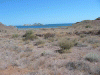 Bahia de Refutio viewed over desert plane
Links to related images: Nearby. Proofs. Map.
Approximate location: 29.5273132324219N / 113.55460357666W.
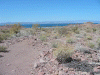 view south over desert plane
Links to related images: Nearby. Proofs. Map.
Approximate location: 29.5244750976562N / 113.555892944336W.
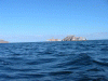
 cacti and offshore rocks
Links to related images: Nearby. Proofs. Map.
Approximate location: 29.5165576934814N / 113.560180664062W.
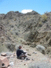
 Photographer Patrick
Links to related images: Nearby. Proofs. Map.
Approximate location: 29.5165576934814N / 113.560180664062W.
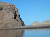
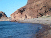
 rocks at low tide on n end of Angel de la Guarda
Links to related images: Nearby. Proofs. Map.
Approximate location: 29.5165576934814N / 113.560180664062W.

 roca over desert plane
Links to related images: Nearby. Proofs. Map.
Approximate location: 29.5115547180176N / 113.554260253906W.
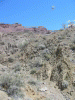
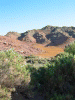
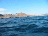
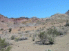 mountains on n end of of Angel de la Guarda
Links to related images: Nearby. Proofs. Map.
Approximate location: 29.5115547180176N / 113.554260253906W.
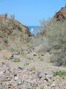 roca viewed down arroyo
Links to related images: Nearby. Proofs. Map.
Approximate location: 29.5063991546631N / 113.543869018555W.
 Patrick at rest stop on arroyo walk
Links to related images: Nearby. Proofs. Map.
Approximate location: 29.5074462890625N / 113.536491394043W.
 arroyo not taken
Links to related images: Nearby. Proofs. Map.
Approximate location: 29.5074462890625N / 113.536491394043W.
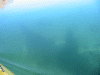
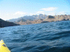
 Patrick on afternoon exploration paddle
Links to related images: Nearby. Proofs. Map.
Approximate location: 29.5372467041016N / 113.552368164062W.
 bitern on cliff?
Links to related images: Nearby. Proofs. Map.
Approximate location: 29.5482234954834N / 113.559150695801W.
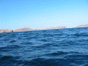
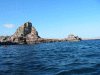
 rocks on n end of Bahia de Refugio
Links to related images: Nearby. Proofs. Map.
Approximate location: 29.5497150421143N / 113.560180664062W.
 boat shadow in natural harbor
Links to related images: Nearby. Proofs. Map.
Approximate location: 29.5571823120117N / 113.562759399414W.
 natural breakwater in natural harbor
Links to related images: Nearby. Proofs. Map.
Approximate location: 29.5571823120117N / 113.562759399414W.
 Solstice in Bahia de Refugio
Links to related images: Nearby. Proofs. Map.
Approximate location: 29.5571823120117N / 113.562759399414W.
 Konstantin's beach in Bahia de Refugio
Links to related images: Nearby. Proofs. Map.
Approximate location: 29.5432949066162N / 113.5625W.
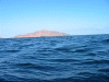
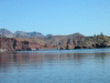
 Bahia de Refugio
Links to related images: Nearby. Proofs. Map.
Approximate location: 29.5462818145752N / 113.555458068848W.
All text and images Copyright © 2003 by Mike Higgins / contact