Baja, Punta San Juan Bautista to Playa la Palmita, March 29th 2002.
Click on the small image to see the full-sized one.

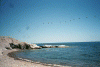
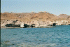
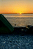 Sunrise at Bahia San Juan Bautista
Links to related images: Nearby. Map.
Approximate location: 28.0210762023926N / 112.802978515625W.
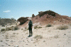
 Joe stopping to photograph osprey nest
Links to related images: Nearby. Map.
Approximate location: 28.0086479187012N / 112.791221618652W.
 Gravel beach for rest stop
Links to related images: Nearby. Map.
Approximate location: 27.9050102233887N / 112.765563964844W.
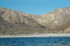
 The view south
Links to related images: Nearby. Map.
Approximate location: 27.8923435211182N / 112.759033203125W.
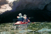
 Kayakers viewed out cave
Links to related images: Nearby. Map.
Approximate location: 27.9024314880371N / 112.764358520508W.
 Bob Stender on rest stop beach
Links to related images: Nearby. Map.
Approximate location: 27.9022789001465N / 112.763671875W.
 Lunch stop beach
Links to related images: Nearby. Map.
Approximate location: 27.9022789001465N / 112.763671875W.
 Joe and Mary Marcia in front of conglomerate bluff
Links to related images: Nearby. Map.
Approximate location: 27.8999290466309N / 112.761268615723W.
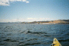
 Baja rocky shoreling
Links to related images: Nearby. Map.
Approximate location: 27.8999290466309N / 112.761268615723W.
 Joe and Mary Marcia entering cave
Links to related images: Nearby. Map.
Approximate location: 27.8999290466309N / 112.761268615723W.
 Pelicans at lunch stop beach
Links to related images: Nearby. Map.
Approximate location: 27.9039478302002N / 112.765563964844W.
 Penny at lunch stop beach
Links to related images: Nearby. Map.
Approximate location: 27.9039478302002N / 112.765563964844W.
 John Barnett at lunch stop beach
Links to related images: Nearby. Map.
Approximate location: 27.9039478302002N / 112.765563964844W.
 Joe snorkeling at lunch stop beach
Links to related images: Nearby. Map.
Approximate location: 27.9039478302002N / 112.765563964844W.
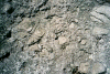
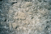 Patterns in the stone at lunch stop beach
Links to related images: Nearby. Map.
Approximate location: 27.9015216827393N / 112.762557983398W.
 Standing stones at lunch stop beach
Links to related images: Nearby. Map.
Approximate location: 27.9011421203613N / 112.763160705566W.
 Fish caught by John at lunch stop beach
Links to related images: Nearby. Map.
Approximate location: 27.9024314880371N / 112.763244628906W.
 The view across the cove at lunch stop beach
Links to related images: Nearby. Map.
Approximate location: 27.9024314880371N / 112.763244628906W.
 John Barnett catching more fish at lunch stop beach
Links to related images: Nearby. Map.
Approximate location: 27.9024314880371N / 112.763244628906W.
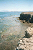
 Reef and green water at lunch stop beach
Links to related images: Nearby. Map.
Approximate location: 27.9015979766846N / 112.76375579834W.
 Standing stones at lunch stop beach
Links to related images: Nearby. Map.
Approximate location: 27.9021282196045N / 112.763160705566W.
 Submerged reef from above at lunch stop beach
Links to related images: Nearby. Map.
Approximate location: 27.9021282196045N / 112.763160705566W.
 Kayaks viewed from above at lunch stop beach
Links to related images: Nearby. Map.
Approximate location: 27.9022045135498N / 112.764526367188W.
 Leaving lunch stop beach
Links to related images: Nearby. Map.
Approximate location: 27.9015979766846N / 112.760925292969W.
 Sandy beach at Playa la Palmita
Links to related images: Nearby. Map.
Approximate location: 27.8877906799316N / 112.767875671387W.
All text and images Copyright © 2002 by Mike Higgins / contact