Gorda Point to La Cruz Rock, August 14th 2001.
Click on the small image to see the full-sized one.
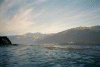
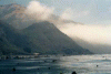
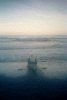 Konstantin launching in morning
Links to related images: Nearby. Proofs. Map.
Approximate location: 35.932430267334N / 121.474800109863W.
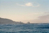
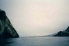
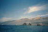
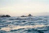 Plaskett Rock from the north
Links to related images: Nearby. Proofs. Map.
Approximate location: 35.9245758056641N / 121.478065490723W.
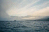
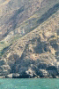
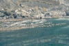
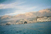
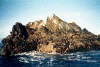 Plaskett Rock up close
Links to related images: Nearby. Proofs. Map.
Approximate location: 35.9211692810059N / 121.477714538574W.
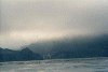
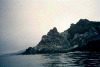
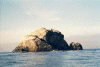 plaskett Rock from the south
Links to related images: Nearby. Proofs. Map.
Approximate location: 35.9160270690918N / 121.476516723633W.
 View north past plaskett rock
Links to related images: Nearby. Proofs. Map.
Approximate location: 35.9160270690918N / 121.476516723633W.
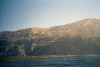
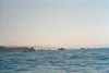
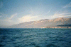
 Cape San Martin from the north
Links to related images: Nearby. Proofs. Map.
Approximate location: 35.9058074951172N / 121.471710205078W.
 Plaskett rock from a distance
Links to related images: Nearby. Proofs. Map.
Approximate location: 35.9058074951172N / 121.471710205078W.
 Bog sir bridge
Links to related images: Nearby. Proofs. Map.
Approximate location: 35.9031639099121N / 121.468101501465W.
 Approaching Cape San Martin
Links to related images: Nearby. Proofs. Map.
Approximate location: 35.891414642334N / 121.466300964355W.
 Cape San Martin from inside pan 1/2
Links to related images: Nearby. Proofs. Map.
Approximate location: 35.8887023925781N / 121.465614318848W.
 Cape San Martin from inside pan 2/2
Links to related images: Nearby. Proofs. Map.
Approximate location: 35.8887023925781N / 121.465614318848W.
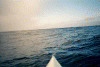 Beautiful reflections on water
Links to related images: Nearby. Proofs. Map.
Approximate location: 35.8832778930664N / 121.463813781738W.
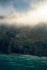
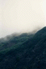
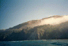 Big Sur cliffs with wisp of fog
Links to related images: Nearby. Proofs. Map.
Approximate location: 35.8751411437988N / 121.453170776367W.
 big sur cliffs no fog
Links to related images: Nearby. Proofs. Map.
Approximate location: 35.8656806945801N / 121.440811157227W.
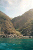
 Peter's cabin on Big Sur?
Links to related images: Nearby. Proofs. Map.
Approximate location: 35.8005523681641N / 121.355667114258W.
 out of focus otter?
Links to related images: Nearby. Proofs. Map.
Approximate location: 35.7927551269531N / 121.346740722656W.
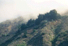
 big sur cliff with fog
Links to related images: Nearby. Proofs. Map.
Approximate location: 35.7855110168457N / 121.338500976562W.
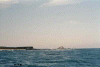
 Approaching Ragged Point
Links to related images: Nearby. Proofs. Map.
Approximate location: 35.7768783569336N / 121.336097717285W.
 Ragged point from the south
Links to related images: Nearby. Proofs. Map.
Approximate location: 35.7548713684082N / 121.323738098145W.
 La Cruz Rock
Links to related images: Nearby. Proofs. Map.
Approximate location: 35.712230682373N / 121.319961547852W.
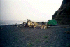
 Our campground behind La Cruz Rock
Links to related images: Nearby. Proofs. Map.
Approximate location: 35.7095146179199N / 121.311210632324W.
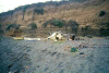
 Pelicans on the La Cruz Rock Beach
Links to related images: Nearby. Proofs. Map.
Approximate location: 35.7095146179199N / 121.311210632324W.
All text and images Copyright © 2001 by Mike Higgins / contact