Gold Bluff Beach to Stone Lagoon to Split Rock. Saturday August 14th 1999.
Click on the small image to see the full-sized one.
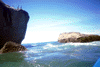
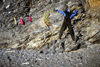
 Del Norte, split rock vertical
Links to related images: Nearby. Proofs. Map.
Approximate location: 41.4952545166016N / 124.076797485352W.
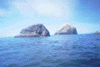
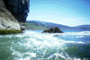
 Del Norte, offshore rock N of Split Rock
Links to related images: Nearby. Proofs. Map.
Approximate location: 41.5037231445312N / 124.080680847168W.
 Del Norte, foam spelling characters again
Links to related images: Nearby. Proofs. Map.
Approximate location: 41.505298614502N / 124.081199645996W.
 Del Norte, offshore rock N of Split Rock
Links to related images: Nearby. Proofs. Map.
Approximate location: 41.5039978027344N / 124.080574035645W.

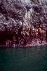 Del Norte, closeup of barnicle covered rock
Links to related images: Nearby. Proofs. Map.
Approximate location: 41.504222869873N / 124.080940246582W.
 Del Norte, offshore rock N of Split Rock
Links to related images: Nearby. Proofs. Map.
Approximate location: 41.5060882568359N / 124.08154296875W.
 Del Norte, whale spouting!
Links to related images: Nearby. Proofs. Map.
Approximate location: 41.5378799438477N / 124.096755981445W.
 Del Norte, whale flukes diving!
Links to related images: Nearby. Proofs. Map.
Approximate location: 41.5378799438477N / 124.096755981445W.
 Del Norte, whale flukes over a wave.
Links to related images: Nearby. Proofs. Map.
Approximate location: 41.5378799438477N / 124.096755981445W.


 Del Norte, approaching the N side of Klamath R.
Links to related images: Nearby. Proofs. Map.
Approximate location: 41.5629005432129N / 124.098815917969W.
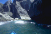
 Del Norte, the outside of the best kayak cave
Links to related images: Nearby. Proofs. Map.
Approximate location: 41.5641822814941N / 124.099456787109W.
 Del Norte, the arch on the west side.
Links to related images: Nearby. Proofs. Map.
Approximate location: 41.5643768310547N / 124.098899841309W.
 Del Norte, harpoon distance to a seal
Links to related images: Nearby. Proofs. Map.
Approximate location: 41.5726280212402N / 124.103324890137W.
 Del Norte, tree covered cliffs N of beach
Links to related images: Nearby. Proofs. Map.
Approximate location: 41.572208404541N / 124.101387023926W.
 Del Norte, view north with spectacular clouds
Links to related images: Nearby. Proofs. Map.
Approximate location: 41.3708000183105N / 124.077003479004W.
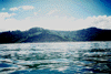
 Del Norte, Redwood Creek distant
Links to related images: Nearby. Proofs. Map.
Approximate location: 41.3014984130859N / 124.092002868652W.
 Del Norte, camper city on Freshwater Lagoon
Links to related images: Nearby. Proofs. Map.
Approximate location: 41.3014984130859N / 124.092002868652W.
 Del Norte, freshwater rocks, S end of this trip
Links to related images: Nearby. Proofs. Map.
Approximate location: 41.3014984130859N / 124.092002868652W.

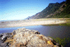
 Del Norte, lunch at my Gold Bluff Camp
Links to related images: Nearby. Proofs. Map.
Approximate location: 41.3708000183105N / 124.077003479004W.
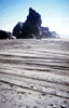
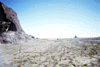
 Del Norte, tire tracks in sand off Johnsons Creek
Links to related images: Nearby. Proofs. Map.
Approximate location: 41.4416999816895N / 124.065002441406W.
 Del Norte, tire tracks in sand off Johnsons Creek
Links to related images: Nearby. Proofs. Map.
Approximate location: 41.4416999816895N / 124.065002441406W.
 Del Norte, long hike to Johnsons Creek
Links to related images: Nearby. Proofs. Map.
Approximate location: 41.4416999816895N / 124.065002441406W.
 Del Norte, close up of end of Johnsons Creek
Links to related images: Nearby. Proofs. Map.
Approximate location: 41.4416999816895N / 124.065002441406W.
 Del Norte, rock with tree S of False Klamath Cove
Links to related images: Nearby. Proofs. Map.
Approximate location: 41.5970001220703N / 124.109001159668W.
 Del Norte, fog bank rolls in over rock garden
Links to related images: Nearby. Proofs. Map.
Approximate location: 41.5970001220703N / 124.109001159668W.
 Del Norte, close to shore in a calm rock garden
Links to related images: Nearby. Proofs. Map.
Approximate location: 41.5970001220703N / 124.109001159668W.
 Del Norte, another rock garden ahead
Links to related images: Nearby. Proofs. Map.
Approximate location: 41.5970001220703N / 124.109001159668W.
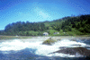
 Del Norte, working through a rock garden
Links to related images: Nearby. Proofs. Map.
Approximate location: 41.5970001220703N / 124.109001159668W.
 Del Norte, the wave that almost got my camera
Links to related images: Nearby. Proofs. Map.
Approximate location: 41.5970001220703N / 124.109001159668W.
 Del Norte, false Klamath rocks?
Links to related images: Nearby. Proofs. Map.
Approximate location: 41.5970001220703N / 124.109001159668W.

 Del Norte, false Klamath cove over a row of rocks
Links to related images: Nearby. Proofs. Map.
Approximate location: 41.5970001220703N / 124.109001159668W.
 Del Norte, Footsteps Rock from the south
Links to related images: Nearby. Proofs. Map.
Approximate location: 41.5970001220703N / 124.109001159668W.
 Del Norte, exfoliated pieces of Footsteps Rock
Links to related images: Nearby. Proofs. Map.
Approximate location: 41.5970001220703N / 124.109001159668W.
 Del Norte, looking W out of Footsteps Rock
Links to related images: Nearby. Proofs. Map.
Approximate location: 41.5970001220703N / 124.109001159668W.
 Del Norte, looking N of Footsteps Rock
Links to related images: Nearby. Proofs. Map.
Approximate location: 41.5970001220703N / 124.109001159668W.
 Del Norte, Footsteps Rock from the West
Links to related images: Nearby. Proofs. Map.
Approximate location: 41.5970001220703N / 124.109001159668W.
 Del Norte, looking E into Footsteps Rock
Links to related images: Nearby. Proofs. Map.
Approximate location: 41.5970001220703N / 124.109001159668W.
 Del Norte, looking S out of Footsteps Rock
Links to related images: Nearby. Proofs. Map.
Approximate location: 41.5970001220703N / 124.109001159668W.
 Del Norte, looking up from inside Footsteps Rock
Links to related images: Nearby. Proofs. Map.
Approximate location: 41.5970001220703N / 124.109001159668W.
 Del Norte, looking into another exfoliation
Links to related images: Nearby. Proofs. Map.
Approximate location: 41.5970001220703N / 124.109001159668W.
 Del Norte, footsteps rock from the NW
Links to related images: Nearby. Proofs. Map.
Approximate location: 41.5970001220703N / 124.109001159668W.
 Del Norte, footsteps Rock from the SW
Links to related images: Nearby. Proofs. Map.
Approximate location: 41.5970001220703N / 124.109001159668W.

 Del Norte, Redwood Youth Hostel over rocks
Links to related images: Nearby. Proofs. Map.
Approximate location: 41.5970001220703N / 124.109001159668W.
 Del Norte, looking back over beach from creek
Links to related images: Nearby. Proofs. Map.
Approximate location: 41.4416999816895N / 124.065002441406W.
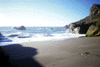 Del Norte, back to Split Rock Beach
Links to related images: Nearby. Proofs. Map.
Approximate location: 41.5190010070801N / 124.083000183105W.
 Del Norte, back to split rock beach
Links to related images: Nearby. Proofs. Map.
Approximate location: 41.5190010070801N / 124.083000183105W.
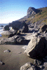
 Del Norte, N end of split rock beach
Links to related images: Nearby. Proofs. Map.
Approximate location: 41.5190010070801N / 124.083000183105W.
 Del Norte, Split Rock above beach campground
Links to related images: Nearby. Proofs. Map.
Approximate location: 41.5190010070801N / 124.083000183105W.
 Del Norte, suff drying at split rock beach
Links to related images: Nearby. Proofs. Map.
Approximate location: 41.5190010070801N / 124.083000183105W.
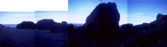 Del Norte, colage of monolith ringing my camp
Links to related images: Nearby. Proofs. Map.
Approximate location: 41.5190010070801N / 124.083000183105W.
All text and images Copyright © 1999 by Mike Higgins / contact