Kauai, Kee Beach to Milolii Beach, Sunday April 20th 1997.
Click on the small image to see the full-sized one.
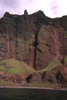 Waterfall carving knotch in cliff
Links to related images: Nearby. Proofs. Map.
Approximate location: 22.1639575958252N / 159.699325561523W.
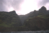
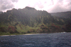
 Na Pali Trail visible near shoreline
Links to related images: Nearby. Proofs. Map.
Approximate location: 22.1656265258789N / 159.691345214844W.
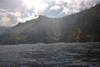
 Hidden valley behind shoreline cliff
Links to related images: Nearby. Proofs. Map.
Approximate location: 22.1653099060059N / 159.686538696289W.
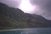
 Green clad mountains rising into the mist
Links to related images: Nearby. Proofs. Map.
Approximate location: 22.1674556732178N / 159.683197021484W.
 Waterfall to rocky shoreline
Links to related images: Nearby. Proofs. Map.
Approximate location: 22.1678524017334N / 159.679931640625W.
 Jamie inside the double door cave
Links to related images: Nearby. Proofs. Map.
Approximate location: 22.1682510375977N / 159.676498413086W.
 Jamie entering a waterfal cave
Links to related images: Nearby. Proofs. Map.
Approximate location: 22.1682510375977N / 159.676498413086W.
 Jamie under a waterfall
Links to related images: Nearby. Proofs. Map.
Approximate location: 22.1682510375977N / 159.676498413086W.
 Jamie in the 'Open Ceiling Cave'.
Links to related images: Nearby. Proofs. Map.
Approximate location: 22.1673755645752N / 159.672714233398W.


 Jamie in the 'Open Ceiling Cave'.
Links to related images: Nearby. Proofs. Map.
Approximate location: 22.1673755645752N / 159.672714233398W.

 Jamie close to shore near the Honopu Valley
Links to related images: Nearby. Proofs. Map.
Approximate location: 22.1742916107178N / 159.662338256836W.


 The two beaches separated by an arch in the Honopu Valley. I want to land
he
The two beaches separated by an arch in the Honopu Valley. I want to land
he
Links to related images: Nearby. Proofs. Map.
Approximate location: 22.1742916107178N / 159.662338256836W.
 The view south from Kalalau Beach
Links to related images: Nearby. Proofs. Map.
Approximate location: 22.1843852996826N / 159.645858764648W.
 Views of the Kalalau Beach campground from the ocean.
Links to related images: Nearby. Proofs. Map.
Approximate location: 22.1843852996826N / 159.645858764648W.
 Views of the Kalalau Beach campground from the ocean.
Links to related images: Nearby. Proofs. Map.
Approximate location: 22.1843852996826N / 159.645858764648W.

 Cliffs north of Kalalau Beach. Can you see the Na Pali Trail?
Links to related images: Nearby. Proofs. Map.
Approximate location: 22.1929683685303N / 159.635375976562W.
 End of Na'Pali coast
Links to related images: Nearby. Proofs. Map.
Approximate location: 22.1929683685303N / 159.635375976562W.

 Kalalau Beach?
Links to related images: Nearby. Proofs. Map.
Approximate location: 22.1765956878662N / 159.659072875977W.
 View out cave
Links to related images: Nearby. Proofs. Map.
Approximate location: 22.1941604614258N / 159.629547119141W.
 Na'Pali mountains
Links to related images: Nearby. Proofs. Map.
Approximate location: 22.2218933105469N / 159.608520507812W.
 Kalalau Beach dist.
Links to related images: Nearby. Proofs. Map.
Approximate location: 22.1773910522461N / 159.674270629883W.
 Honopu Valley
Links to related images: Nearby. Proofs. Map.
Approximate location: 22.1835899353027N / 159.660873413086W.
 Na'Pali mountains
Links to related images: Nearby.
Approximate location: 22.2045707702637N / 159.647476196289W.
 Spining dolphin
Links to related images: Nearby.
Approximate location: 22.2045707702637N / 159.647476196289W.
 Dolphins
Links to related images: Nearby.
Approximate location: 22.2045707702637N / 159.647476196289W.
 Na'Pali mountains
Links to related images: Nearby.
Approximate location: 22.1942405700684N / 159.661392211914W.
 Tour boat
Links to related images: Nearby.
Approximate location: 22.1942405700684N / 159.661392211914W.
 Na'Pali view N
Links to related images: Nearby. Proofs. Map.
Approximate location: 22.1641960144043N / 159.720443725586W.
 Jamie just making it over ?16 foot waves at Milolii Beach
Links to related images: Nearby. Proofs. Map.
Approximate location: 22.1525897979736N / 159.717514038086W.
 Milolii waves
Links to related images: Nearby. Proofs. Map.
Approximate location: 22.1525897979736N / 159.717514038086W.

 Milolii Valley
Links to related images: Nearby. Proofs. Map.
Approximate location: 22.1505241394043N / 159.71614074707W.
 Milolii waves
Links to related images: Nearby. Proofs. Map.
Approximate location: 22.1524314880371N / 159.717346191406W.

 Milolii Beach
Links to related images: Nearby. Proofs. Map.
Approximate location: 22.1551342010498N / 159.722671508789W.
 Peak, rough seas
Links to related images: Nearby. Proofs. Map.
Approximate location: 22.1943988800049N / 159.632202148438W.
 waterfal in cave, rough
Links to related images: Nearby. Proofs. Map.
Approximate location: 22.1986904144287N / 159.625854492188W.
 Jamie on big swell
Links to related images: Nearby. Proofs. Map.
Approximate location: 22.2279319763184N / 159.590148925781W.
 breakers in caves
Links to related images: Nearby. Proofs. Map.
Approximate location: 22.2015514373779N / 159.619674682617W.
 caves on rough day
Links to related images: Nearby. Proofs. Map.
Approximate location: 22.2207813262939N / 159.594436645508W.
 Waterfall in very rough water
Links to related images: Nearby. Proofs. Map.
Approximate location: 22.1948757171631N / 159.632888793945W.
 Jamie looking into cave in rough water
Links to related images: Nearby. Proofs. Map.
Approximate location: 22.195987701416N / 159.63134765625W.
 Jamie UNDER the stone triangle over our heads
Links to related images: Nearby. Proofs. Map.
Approximate location: 22.195987701416N / 159.63134765625W.
All text and images Copyright © 1997 by Mike Higgins / contact