Port San Luis, Sunday March 30th 1997.
Click on the small image to see the full-sized one.
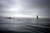 Don Fleming out past the end of the breakwater at Point San Luis.
Links to related images: Nearby. Proofs. Map.
Approximate location: 35.155200958252N / 120.75700378418W.
 We went out to the end of the breakwater at Point San Luis.
Links to related images: Nearby. Proofs. Map.
Approximate location: 35.1551513671875N / 120.757499694824W.
 I sat under the breaker for a while waiting for a wave to break over.
Links to related images: Nearby. Proofs. Map.
Approximate location: 35.1551513671875N / 120.757499694824W.
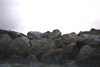
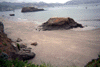
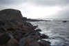
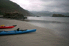
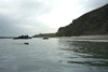
 Beach near Point San Luis.
Links to related images: Nearby. Proofs. Map.
Approximate location: 35.1551513671875N / 120.757499694824W.
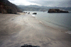
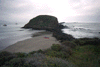
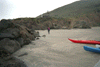
 Beach behind Whalers Island at Point San Luis.
Links to related images: Nearby. Proofs. Map.
Approximate location: 35.1551513671875N / 120.757499694824W.
 San Luis Lighthouse.
Links to related images: Nearby. Proofs. Map.
Approximate location: 35.1551513671875N / 120.757499694824W.
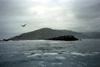
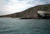
 Whalers Island at Point San Luis.
Links to related images: Nearby. Proofs. Map.
Approximate location: 35.1551513671875N / 120.757499694824W.
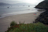
 Beach behind Whalers Island at Point San Luis.
Links to related images: Nearby. Proofs. Map.
Approximate location: 35.1551513671875N / 120.757499694824W.
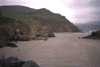
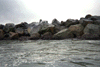
 Rough water north of Point San Luis Breaker.
Links to related images: Nearby. Proofs. Map.
Approximate location: 35.1551513671875N / 120.757499694824W.
 Beach behind Whalers Island at Point San Luis.
Links to related images: Nearby. Proofs. Map.
Approximate location: 35.1551513671875N / 120.757499694824W.
 Waves breaking over the Point San Luis Breakwater.
Links to related images: Nearby. Proofs. Map.
Approximate location: 35.1551513671875N / 120.757499694824W.
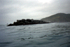
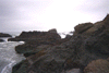
 Point San Luis Breaker and Whalers Island.
Links to related images: Nearby. Proofs. Map.
Approximate location: 35.1551513671875N / 120.757499694824W.
 Beach behind Whalers Island at Point San Luis.
Links to related images: Nearby. Proofs. Map.
Approximate location: 35.1551513671875N / 120.757499694824W.
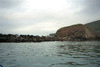
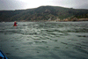 Don Fleming in San Luis Obispo Bay.
Links to related images: Nearby. Proofs. Map.
Approximate location: 35.1551513671875N / 120.757499694824W.
All text and images Copyright © 1997 by Mike Higgins / contact