San Quentin to Horseshoe Bay, November 24th 1996.
Click on the small image to see the full-sized one.
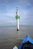 The 'Gonzo Bay Tour' went under the Richmond Bridge near here.
Links to related images: Nearby. Proofs. Map.
Approximate location: 37.9435195922852N / 122.45979309082W.

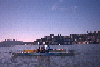
 Joan in the Yellow Bluff tidal rip
Links to related images: Nearby. Proofs. Map.
Approximate location: 37.8352088928223N / 122.471038818359W.

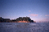
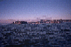 Late in the day at Yellow Bluff
Links to related images: Nearby. Proofs. Map.
Approximate location: 37.8352088928223N / 122.471038818359W.
 Paddling close to Angel Island
Links to related images: Nearby. Proofs. Map.
Approximate location: 37.8686981201172N / 122.439002990723W.
 Perls Beach on Angel Island
Links to related images: Nearby. Proofs. Map.
Approximate location: 37.8552017211914N / 122.439002990723W.
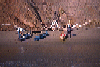
 Pictures from several tidal rip paddles to Yellow Bluff.
Links to related images: Nearby. Proofs. Map.
Approximate location: 37.8629264831543N / 122.453269958496W.
 Pictures from several tidal rip paddles to Yellow Bluff.
Links to related images: Nearby. Proofs. Map.
Approximate location: 37.8621826171875N / 122.452583312988W.

 Pictures from several tidal rip paddles to Yellow Bluff.
Links to related images: Nearby. Proofs. Map.
Approximate location: 37.8379211425781N / 122.46159362793W.
All text and images Copyright © 1996 by Mike Higgins / contact