McKerricher State Park to Noyo Bay, September 11th 1996.
Click on the small image to see the full-sized one.
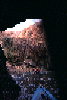 Paul Futcher in one of the Noyo Caves
Links to related images: Nearby. Proofs. Map.
Approximate location: 39.4309883117676N / 123.815544128418W.

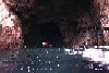
 Paul Futcher entering the Noyo Caves
Links to related images: Nearby. Proofs. Map.
Approximate location: 39.4307975769043N / 123.815567016602W.
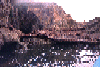
 Paul Futcher inside one of the Noyo Caves
Links to related images: Nearby. Proofs. Map.
Approximate location: 39.4307975769043N / 123.815567016602W.
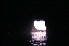
 Me in Noyo Cave, Paul outside
Links to related images: Nearby. Proofs. Map.
Approximate location: 39.4307975769043N / 123.815567016602W.
 Noyo Cave entrances
Links to related images: Nearby. Proofs. Map.
Approximate location: 39.4304656982422N / 123.815841674805W.
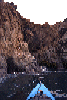
 Paul Futcher along Mendocino coastline
Links to related images: Nearby. Proofs. Map.
Approximate location: 39.433666229248N / 123.819801330566W.
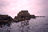
 Fort Bragg coastline with lumber yard
Links to related images: Nearby. Proofs. Map.
Approximate location: 39.4385795593262N / 123.821601867676W.
 Paul Futcher going through slot on Fort Bragg coastline
Links to related images: Nearby. Proofs. Map.
Approximate location: 39.4369239807129N / 123.820755004883W.
 Strata of rust at Glass Beach
Links to related images: Nearby. Proofs. Map.
Approximate location: 39.4594573974609N / 123.810340881348W.
All text and images Copyright © 1996 by Mike Higgins / contact