Gleasons Beach to Wrights Beach, May 1st 1996.
Click on the small image to see the full-sized one.
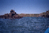
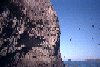
 The inside corner of Duncans Point
Links to related images: Nearby. Proofs. Map.
Approximate location: 38.393798828125N / 123.092002868652W.
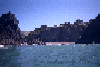
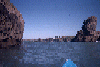
 Looking north through the rock garden at Duncans Cove
Links to related images: Nearby. Proofs. Map.
Approximate location: 38.393798828125N / 123.092002868652W.
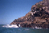
 Houses on the cliff south of Duncans Cove
Links to related images: Nearby. Proofs. Map.
Approximate location: 38.393798828125N / 123.092002868652W.
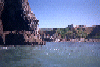
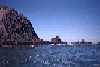 Looking out through the rock garden south of Duncans Cove
Links to related images: Nearby. Proofs. Map.
Approximate location: 38.393798828125N / 123.092002868652W.
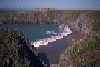
 Birds flying off rock south of Duncans Cove
Links to related images: Nearby. Proofs. Map.
Approximate location: 38.393798828125N / 123.092002868652W.
 Looking north through the rock garden at Duncans Cove
Links to related images: Nearby. Proofs. Map.
Approximate location: 38.393798828125N / 123.092002868652W.
 Houses on the cliff south of Duncans Cove
Links to related images: Nearby. Proofs. Map.
Approximate location: 38.393798828125N / 123.092002868652W.
 Looking down at beautiful Duncans Cove from up on the bluff
Links to related images: Nearby. Proofs. Map.
Approximate location: 38.393798828125N / 123.092002868652W.
All text and images Copyright © 1996 by Mike Higgins / contact