Drakes Beach to Drakes Bay Boat Launch, August 7th 1995
Click on the small image to see the full-sized one.
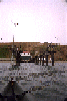 Looking up the launch ramp of the Point Reyes Lifeboat Station
Links to related images: Nearby. Proofs. Map.
Approximate location: 37.9949722290039N / 122.973251342773W.
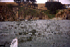 The shore just south of the Point Reyes Lifeboat Station
Links to related images: Nearby. Proofs. Map.
Approximate location: 37.9944725036621N / 122.971534729004W.
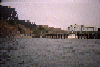 The private pier just north of the Point Reyes Lifeboat Station
Links to related images: Nearby. Proofs. Map.
Approximate location: 37.9959602355957N / 122.976341247559W.
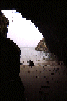 A small cave in Drakes Bay just inside the point
Links to related images: Nearby. Proofs. Map.
Approximate location: 37.9905738830566N / 122.964653015137W.
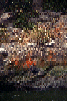 Flowers and lichen on the cliff just inside Drakes Bay
Links to related images: Nearby. Proofs. Map.
Approximate location: 37.9905052185059N / 122.964233398438W.
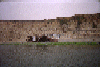 Wrecked boat inside Drakes Bay
Links to related images: Nearby. Proofs. Map.
Approximate location: 37.9911727905273N / 122.965240478516W.
 Pelicans inf ront of Drakes Bay cliffs
Links to related images: Nearby. Proofs. Map.
Approximate location: 37.9894676208496N / 122.96459197998W.
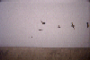 Pelicans in front of Drakes Bay cliffs
Links to related images: Nearby. Proofs. Map.
Approximate location: 37.9894676208496N / 122.96459197998W.
All text and images Copyright © 1995 by Mike Higgins / contact